Area Overview for PL10 1NB
Photos of PL10 1NB
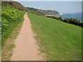
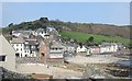
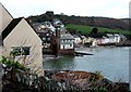
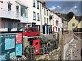
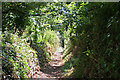
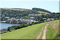
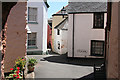
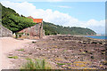
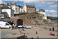
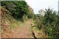
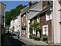
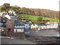
100 photos from this area
Area Information
Key information about the PL10 1NB including its size, population, and administrative classification.
- Area Type
- Postcode
- Area Size
- 1.4 hectares
- Population
- 1735
- Population Density
- 76 people/km²
House Prices in PL10 1NB
18
Properties
£385,859
Average Sold Price
£113,000
Lowest Price
£1,400,000
Highest Price
Showing 18 properties
| Address | Type | Beds | Baths | Last Sale Price | Last Sale Date | |
|---|---|---|---|---|---|---|
| Egloshayle, Fore Street, Kingsand, PL10 1NB | house | - | - | £1,400,000 | Jan 2024 | |
| Sunny Cottage, Fore Street, Kingsand, PL10 1NB | Semi-detached | 2 | 1 | £360,000 | Dec 2023 | |
| Bidborough, Fore Street, Kingsand, PL10 1NB | Detached | 2 | 1 | £407,500 | Nov 2023 | |
| 2, Greenway, Fore Street, Kingsand, PL10 1NB | Semi-detached | 2 | 1 | £313,000 | Apr 2021 | |
| White Cottage, Fore Street, Kingsand, PL10 1NB | Detached | 4 | 2 | £484,000 | Aug 2016 | |
| Thysldo, Fore Street, Kingsand, PL10 1NB | Bungalow | 2 | - | £175,000 | Nov 2015 | |
| Mas-kee, Fore Street, Kingsand, PL10 1NB | Flat | 2 | 1 | £175,000 | Nov 2015 | |
| Home Cottage, Fore Street, Kingsand, PL10 1NB | house | - | - | £407,000 | May 2014 | |
| 1, Greenway, Fore Street, Kingsand, PL10 1NB | Cottage | 2 | - | £169,950 | Apr 2006 | |
| Lexden, Fore Street, Kingsand, PL10 1NB | Terraced | - | - | £240,000 | May 2003 |
Page 1 of 2
Energy Efficiency in PL10 1NB
Amenities
Schools
| Rank | School | Type | Entry gender | Ages |
|---|
Explore more schools in this area
Go to Schools tabDemographics
Household Size
Two person
most common
Accommodation Type
Houses
most common
Tenure
71
majority
Ethnic Group
White
most common
Religion
N/A
most common
Household Composition
N/A
most common
Age
47
median
Adults (30-64 years)
most common
Household Deprivation
N/A
with no deprivation
NS-SEC
39
in Lower managerial occupations
Explore more demographic insights in this area
Go to Demographics tabPlanning
Planning Constraints
- Flood RiskPremium
- Ramsar Wetland SitesPremium
- Area of Outstanding Natural BeautyPremium
- Protected Nature ReservePremium
- Protected WoodlandPremium