Area Overview for Badgeworth
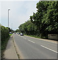
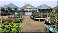
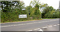
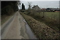
Photos of Badgeworth

Area Information
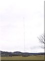
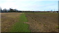
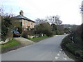
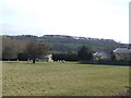
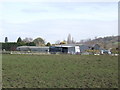
Living in Badgeworth offers a distinctly rural experience within the Tewkesbury district of Gloucestershire. This civil parish covers an area of 13.1 km², encompassing 3,579 acres of clayey soil that defines the local landscape. You will find the settlement situated between Gloucester and Cheltenham, yet it feels worlds away from either town in terms of atmosphere. The village heart features the parish church of Holy Trinity, an architecturally ornate building housing an early 14th-century aisle noted by experts as the best example of medieval decorated style in Gloucestershire. Your daily life revolves around quiet countryside setting rather than urban bustle, anchored by landmarks such as Cold Pool Lane where a mineral spring exists at Cold Pool. While a railway station once operated on the Birmingham and Gloucester Railway, it closed in 1846, leaving the modern infrastructure focused on postal routes that run through Cheltenham. The area includes settlements like Little Shurdington, Little Witcombe, and Bentham within its ancient parish boundaries. Each morning, you enjoy the view of the Bristol Channel rising in the south-west, while handling tasks like shopping requires a trip to nearby urban centres. The historical depth is palpable, with parish registers beginning in 1553 and church records dating back to 1327. You are buying into a location defined by its centuries-old heritage and wide open spaces rather than any contemporary commercial hub.
- Area Type
- Parish
- Area Size
- 13.1 km²
- Population
- Not available
- Population Density
- Not available
Demographics
The community character of Badgeworth is shaped primarily by an older population profile. The median age for residents stands at 70 years, indicating a population skewed significantly towards older adults. Households in the area reflect this demographic reality, with the majority of residents falling into the 'Age: Total' category as reported by local statistics. Home ownership is highly prevalent in this village, with 80% of residents owning their homes outright or with a mortgage. This high rate of ownership suggests a stable community where long-term residents dominate the local landscape. Accommodation types in Badgeworth reflect the needs of this specific age group, though the data does not specify the split between semi-detached, terraced, or detached properties. The community maintains a traditional structure where most people settle down to retire rather than move for career opportunities. Diversity in Badgeworth follows the pattern typical of many Gloucestershire parishes, with a predominant ethnic group aligning with the regional average. Religious affiliation, like other social metrics, follows the standard distribution for the county. You will find that daily interactions centre around neighbours who have lived here for decades, creating a familiar social fabric despite the lack of youth-focused amenities. The household composition reveals a community built around retirement and established families rather than transient populations.
Household Size
Accommodation Type
Tenure
Ethnic Group
Religion
Household Composition
Age
Household Deprivation
NS-SEC
Explore more demographic insights in this area
Go to Demographics tabPlanning
Planning Constraints
- Flood RiskPremium
- Ramsar Wetland SitesPremium
- Area of Outstanding Natural BeautyPremium
- Protected Nature ReservePremium
- Protected WoodlandPremium