Area Overview for Gloucestershire
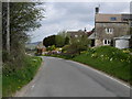
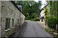
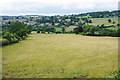
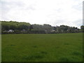
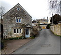
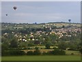
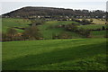
Photos of Gloucestershire

Area Information
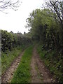
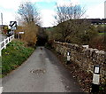
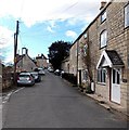
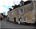
Gloucestershire sits in South West England and covers an extensive 3,243.6 square kilometres. You will find a ceremonial county that borders here and the Welsh area of Monmouthshire to the west, alongside organisations like Herefordshire and Worcestershire to the north. The landscape is predominantly rural, yet it contains significant urban hubs. The city of Gloucester acts as the county town and the largest settlement, located in the north-centre. Just to the east lies the spa town of Cheltenham, while other key towns include Tewkesbury, Cirencester, Stroud, and Yate. These settlements sit along the River Severn, which is bisected by the area and forms a wide valley through the centre before broadening into a large tidal estuary. Living in Gloucestershire means access to three designated national landscapes. The Cotswolds occupy the eastern portion with their honey-coloured villages. In the west, the Forest of Dean and the Wye Valley offer extensive upland scenery. Dean National Forest Park forms a large area west and south of Cinderford. The Vale of Gloucester has historically served as a major route between the Midlands and the West Country. Today, this corridor includes Roman roads, canals, railways, and a major superhighway linking the West Midlands conurbation and Greater Bristol. Gloucester itself functions as an inland port linked via the Gloucester and Sharpness Canal to the Severn Estuary. The far south, including Filton and Kingswood, is densely populated and forms part of the Bristol built-up area. Despite the rural character, you can find vibrant multi-cultural city life in Gloucester alongside idyllic escapes amidst stunning scenery.
- Area Type
- Ceremonial Counties Region
- Area Size
- 3243.6 km²
- Population
- Not available
- Population Density
- Not available
Demographics
The community in Gloucestershire reflects a distinct maturity in its population structure. The median age for the area stands at 70 years, indicating a significantly older demographic compared to many other regions. You will note that the most common age range grouping is listed simply as "Age: Total" in the available records, meaning specific breakdowns for particular decades are not detailed in the source material. There is no granular data available on the specific most common age range, yet the high median age points strongly toward a retirement-focused or older population base. Home ownership is a defining feature of life here, with 70% of residents owning their properties outright or with a mortgage. This high rate suggests stability and long-term settlement rather than a transient rental market. The source information lists the household composition as "total" and the predominant ethnic group as "total" without providing specific percentages or breakdowns. Similarly, while religion and accommodation type are listed as "total", the data does not include specific figures for these categories. The available figures show a clear picture of an owner-occupier stronghold. Regarding deprivation, the provided data does not contain specific statistics on deprivation levels or indices for any part of the county. You must rely on the high home ownership rate and the older age profile to gauge the social environment rather than waiting for specific deprivation data that is absent from the current records.