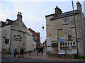
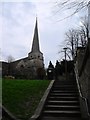
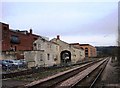
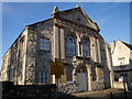
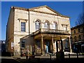
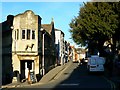
Area Overview for Stroud
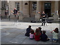
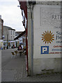
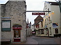
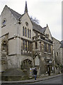
Photos of Stroud


Area Information
Living in Stroud offers a defined尺度 to those seeking a specific type of settled life within a civil parish. This area covers just 7.2 square kilometres, creating an extremely compact neighbourhood where daily necessities are often within easy reach. The small footprint means residents frequently interact on high streets or in local green spaces rather than traversing vast distances. You will find yourself in a setting that prioritises local connections over rapid expansion. The physical boundaries are clear, offering a sense of enclosure that many residents value. Daily life here revolves around familiar landmarks and established routines rather than the unpredictability of a growing city. You navigate this space with the advantage of knowing exactly what surrounds you at any given moment. The compact nature of the parish ensures that you can walk to most amenities without needing extensive transport planning. This simplicity defines the experience of residing in Stroud. The environment is intimate and manageable, which appeals to those who prefer a controlled living situation. You benefit from a landscape where the community remains close-knit because the geography limits sprawl. Every section of this parish contributes to a cohesive local identity that shapes your daily interactions. The size of the area dictates a pace of life that feels deliberate and unhurried compared to larger metropolitan regions. You trade anonymity for a deep connection with your immediate surroundings. This deliberate scale supports a lifestyle focused on local institutions and neighbours rather than distant industrial zones. The small area size inherently fosters a quieter existence for any resident choosing this location.
- Area Type
- Parish
- Area Size
- 7.2 km²
- Population
- Not available
- Population Density
- Not available
Demographics
The community in Stroud presents a distinct demographic profile characterised by significant maturity. The median age of the population stands at 70 years, indicating a settlement dominated by older residents. This age distribution suggests that most households consist of retirees or those approaching retirement. You will encounter a neighbourhood where life experience and established routines define the social fabric. The most common age grouping reflects adults, reinforcing the perception of a later-life community. Home ownership stands at 63%, a figure that surpasses the national average and signals financial stability among residents. This high ownership rate implies that many families have cleared debts and focus on maintaining their properties rather than renting. The accommodation statistics confirm a traditional mix of families and individuals settled long-term. While specific data on household composition details remains general, the high ownership rate strongly suggests stability. The ethnic and religious breakdown of the population is represented by broad totals, reflecting a mix typical of established rural parishes. You should expect a community where long-term residents form the backbone of local engagement. The demographic reality points to an area where services may cater primarily to an older population. The lack of data on specific household subtypes prevents fine-grained analysis of young families or single-person households. However, the overriding statistic of home ownership and the high median age paint a clear picture of a mature, settled community. Residents here share common goals regarding property maintenance and local governance. The population structure supports a steady demand for healthcare and leisure facilities suited to older demographics. You engage with a demographic that values security and familiarity above transient trends. The social dynamic is shaped by neighbours who have lived in Stroud for decades. The 70-year median age is the single most defining characteristic of this community.
Household Size
Accommodation Type
Tenure
Ethnic Group
Religion
Household Composition
Age
Household Deprivation
NS-SEC
Explore more demographic insights in this area
Go to Demographics tabPlanning
Planning Constraints
- Flood RiskPremium
- Ramsar Wetland SitesPremium
- Area of Outstanding Natural BeautyPremium
- Protected Nature ReservePremium
- Protected WoodlandPremium