Area Overview for Brimscombe and Thrupp
Photos of Brimscombe and Thrupp
Area Information
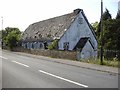
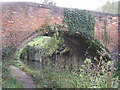
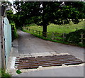
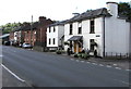
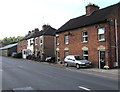
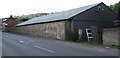
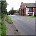
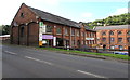
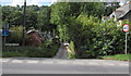
Living in Brimscombe and Thrupp means residing within a narrow civil parish in the Frome Valley. The area sits slightly south-east of Stroud, covering a small footprint of just 3.8 km². This compact size defines daily life, as the villages of Brimscombe and Thrupp are situated close to one another. History runs deep here, with mills recorded as early as the Domesday Book of 1086. Textile production expanded from the 16th century, while Brimscombe Port opened in 1789 to serve the Thames and Severn Canal. Industrial growth followed, featuring cloth mills and iron works like the Phoenix Iron Works, established in 1828. Transport links include the A419 road, built in 1815, and the historic Brimscombe railway station. Today, the landscape retains its heritage through Grade II-listed structures such as the Salt Warehouse. You can walk past buildings like Griffin Mill and Bourne Mills, which have operated since the 1600s. The parish chapelry including Chalford was constituted in 1840, adding another layer to the area's social fabric. A visit to Phoenix Iron Works or the Ham Mill site offers tangible proof of this industrial legacy. The modern community benefits from this unique position in the Gloucestershire countryside. Your daily routine will likely involve navigating the valley floor where these historical and contemporary elements meet.
- Area Type
- Parish
- Area Size
- 3.8 km²
- Population
- Not available
- Population Density
- Not available
Demographics
The community profile of Brimscombe and Thrupp reveals a population with a high median age of 70. Residents in this civil parish are predominantly older adults compared to the national average. You will find that the most common age bracket encompasses the total recorded population, indicating a balanced spread across different decades of life for those who remain. Home ownership stands at 86%, creating a stable environment where most residents have purchased their residences. This high figure suggests limited temporary tenancy and a deep-rooted connection to specific plots within the villages. Accommodation types and predominant ethnic groups are recorded for the area as whole categories without specific breakdowns. You should expect a fairly homogenous community structure based on the existing figures. The low crime risk score of 81 confirms that Brimscombe and Thrupp maintains below-average crime rates. This safety metric indicates a secure neighbourhood for your family. Ramsar wetland sites, Areas of Outstanding Natural Beauty, and protected nature reserves do not cover the parish, meaning no specific planning constraints stem from these environmental designations. However, you must note that the area contains protected woodland, which influences local planning factors. These data points outline a mature, secure living environment where property values likely reflect long-term residence.
Household Size
Accommodation Type
Tenure
Ethnic Group
Religion
Household Composition
Age
Household Deprivation
NS-SEC
Explore more demographic insights in this area
Go to Demographics tabPlanning
Planning Constraints
- Flood RiskPremium
- Ramsar Wetland SitesPremium
- Area of Outstanding Natural BeautyPremium
- Protected Nature ReservePremium
- Protected WoodlandPremium