Area Overview for Thornbury
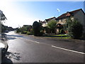
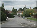
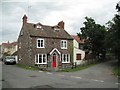
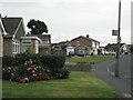
Photos of Thornbury


Area Information
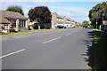
Thornbury is a built-up area within Gloucestershire covering approximately 3.7 square kilometres. Despite its relatively small footprint, the location supports a population of 1,458 residents, creating a tight-knit community environment. The population density stands at 393 people per square kilometre, which suggests a neighbourhood that feels intimate yet avoids the congestion often found in larger towns. Living in Thornbury means experiencing a tranquil setting where residents benefit from a clear sense of community. The area functions as a distinct settlement rather than a sprawling municipality, fostering interactions among neighbours who share the same local services and routes. This concentration of households creates a sustainable community scale where daily life revolves around immediate surroundings. You find yourself in an English locale where the built environment is established and settled. The demographic profile indicates that the residents are largely settled homeowners, contributing to a stable atmosphere. When considering homes in Thornbury, you are entering a space defined by its manageable size and deep-rooted social fabric. The area does not attempt to be a major city; instead, it succeeds by offering a focused residential experience where every resident knows their place in the larger picture of Gloucestershire.
- Area Type
- Built Up Area 250
- Area Size
- 3.7 km²
- Population
- 1458
- Population Density
- 393 people/km²
Daily life in Thornbury benefits from a cluster of essential retail amenities within easy reach. Residents have access to five notable shops, including Morrisons Daily, Spar, and Aldi Thornbury. These supermarkets provide all the basic grocery needs without the need to travel far outside the town limits. For commuters, transport options are accessible through three nearby railway stations. Major hubs within practical reach include Pilning Railway Station, Yate Railway Station, and Patchway Railway Station. These stations connect the built-up area to wider regional networks, making rail travel a viable option for work or leisure. The proximity to these trains enhances the convenience of living here, allowing you to access larger cities while maintaining a smaller community feel. Shopping trips are quick and local, with convenience stores and supermarkets forming the core of the retail landscape. Dining options and larger leisure facilities are likely found in the connected towns accessed via these rail links rather than directly within the 3.7 square kilometre boundary of Thornbury. The combination of local food stores and accessible rail travel creates a balanced lifestyle where routine runs smoothly. You enjoy the freedom of a small town supplemented by the convenience of major transport nodes.
Amenities
Schools
Families considering Thornbury have several primary schools within practical reach of their homes. The nearest educational institutions include Crossways Junior School, which holds a good Ofsted rating. You also have access to Manorbrook Junior School, which serves the local catchment alongside the infant divisions. Crossways Infant School operates in the same cluster and currently holds a satisfactory Ofsted rating. Another option is Gillingstool Primary School, which caters to the broader local education needs. Manorbrook Infants' School rounds out the selection of primary providers near this built-up area. The presence of multiple schools suggests that the area supports families despite its small geographic size. Living in Thornbury gives you access to a network of infant and junior education without the long commutes typical of rural settings. The mix of schools with varying Ofsted ratings indicates a diverse range of educational approaches available to local children. While specific secondary school data is not listed in the immediate vicinity records, these primary institutions form the backbone of local education. Parents can choose between the highly rated Crossways Junior School or other local options depending on their children's needs. The schools named here serve as the main educational anchor for residents of the area.
| Rank | School | Type | Entry gender | Ages |
|---|
Explore more schools in this area
Go to Schools tabDemographics
The community in Thornbury is defined by a very mature resident base. The median age is 70, meaning half of the local population is older than this figure. This age distribution points to a neighbourhood dominated by older adults who have likely lived in the area for many years. Data shows that total age ranges cover the entire population, but the skew towards older demographics is pronounced in this specific built-up area. Home ownership is the defining characteristic of local household composition, with 78% of residents owning their properties outright or with a mortgage. This high percentage indicates that most families view this location as a permanent base rather than a stepping stone. Accommodation types reflect this stability, though specific breakdowns of property age remain part of the general housing stock picture. The area hosts a total number of households that supports this ownership model, creating a low-turnover environment. There is no significant data on predominant ethnic groups or religious affiliations in the current records, meaning the community appears homogenous in its recorded demographics. For those seeking living in Thornbury, the social contract is one of mutual reliance among long-term residents. The high ownership rate combined with an older median age creates a quiet, established village feel where changes happen slowly and deliberately.