Area Overview for Staple Hill and Mangotsfield
Photos of Staple Hill and Mangotsfield


Area Information
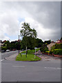
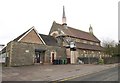
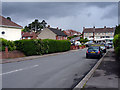
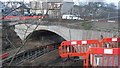
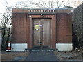
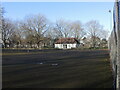
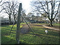
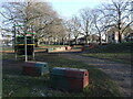
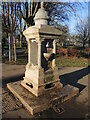
Staple Hill and Mangotsfield defines a distinct civil parish within South Gloucestershire, situated east of Bristol and just outside the city boundary. This area covers 2.4 square kilometres and comprises several distinct localities, including Downend, Bromley Heath, Emerson's Green, and the hamlets of Bury Hill and Moorend. While parts of Soundwell and Oldbury Court integrate into the parish, the name Staple Hill derives from the Anglo-Saxon word *stapol*, meaning a post or boundary marker. The landscape retains traces of its rural past despite significant suburban development over the last century. You will find a community that transformed from a small hamlet in the ancient parish of Mangotsfield into a established residential sector. The architecture is largely Victorian, featuring ornate roof ridges and decorative brickwork that lines the notably broad High Street. This street width was a result of tram lines running along its length in the early 20th century. In the northern extreme, behind the Avon Ring Road and M4 motorway, properties built in the 1960s retain a sliver of the parish's original rural character. The parish contains historic infrastructure, such as the beautifully engineered tunnel beneath Staple Hill, which once facilitated direct access to Bath. Daily life here balances suburban convenience with historical depth. You live near sites like Page Park, which celebrated its centenary in 2010, and Bury Hill, home to an Iron Age fort. The area offers a wide-ranging high street to support local retail needs, moving away from its historical industrial basis involving factories like Carsons Chocolates. Understanding this evolution gives you context for the mix of housing and amenities available in Staple Hill and Mangotsfield today.
- Area Type
- Parish
- Area Size
- 2.4 km²
- Population
- Not available
- Population Density
- Not available
Demographics
The community profile of Staple Hill and Mangotsfield indicates a mature population. The median age across the area is 70 years, suggesting that the neighbourhood is primarily retirement-focused or appeals to older demographics. This aligns with the architectural stock, where Victorian flats and converted properties often suit single occupants or couples later in life. With a home ownership rate of 64%, the majority of residents own their properties outright or with a mortgage, creating a stable residential environment. You will not find significant data on household composition or predominant ethnic groups in the current records, but the high median age typically correlates with smaller household sizes. The accommodation mix reflects this, with a substantial portion of the 2.4 square kilometre area consisting of older Victorian conversions. Large residential properties from the early 20th century were often demolished or converted into apartments, meaning you may encounter flats and maisonettes alongside remaining detached or semi-detached homes. The northern areas built in the 1960s add a different layer to the housing stock. This demographic reality means the area is quiet during the day but can feel very active in the evenings as residents return to their homes. The low population density relative to the median age suggests a peaceful lifestyle rather than a bustling family district. You are looking at a settlement where the primary residents are likely seeking stability and lower noise levels rather than vibrant nightlife or extensive family facilities. The 64% ownership figure reinforces the idea that this is a place where people stay for the long term.
Household Size
Accommodation Type
Tenure
Ethnic Group
Religion
Household Composition
Age
Household Deprivation
NS-SEC
Explore more demographic insights in this area
Go to Demographics tabPlanning
Planning Constraints
- Flood RiskPremium
- Ramsar Wetland SitesPremium
- Area of Outstanding Natural BeautyPremium
- Protected Nature ReservePremium
- Protected WoodlandPremium