Area Overview for Lydbrook
Photos of Lydbrook
Area Information
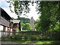
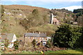
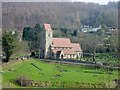
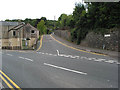
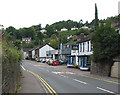
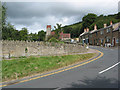
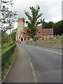
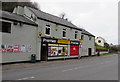
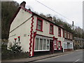
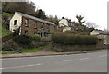
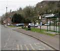
Living in Lydbrook offers a distinct experience within a very compact district. This area spans just 4.9 square kilometres, creating an intimate environment where the landscape and community are tightly interwoven. You are part of a neighbourhood defined by its quiet rural character rather than urban density. The small physical footprint means that daily life revolves around local, immediate surroundings rather than sprawling infrastructure. There is a palpable sense of established history that permeates the local streets. You will notice that the area is not urbanised in the traditional sense, which influences how residents navigate their daily routines. The location serves as a ward within the district borough structure of Gloucestershire, England. Its size dictates that you can traverse the entire locality quickly, yet the setting feels spacious due to the presence of greenery and protected natural spaces. You will find that the layout supports a slower pace compared to larger towns in the region. The proximity to areas of outstanding natural beauty shapes the visual quality of your view from any home. This is a place where the boundary between residential life and the countryside is naturally blurred.
- Area Type
- Parish
- Area Size
- 4.9 km²
- Population
- Not available
- Population Density
- Not available
Demographics
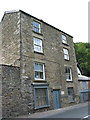
The community profile in Lydbrook reflects a settled and mature population. The median age here is 70 years, which signifies that the resident body leans heavily towards older individuals. This age distribution suggests a neighbourhood where long-standing families and retirees form the core of daily life. You will encounter fewer young families or students compared to areas with younger demographics. The household composition aligns with this age profile, indicating that homes often accommodate singles, couples, or older generational households. Home ownership stands at an impressive 74% within Lydbrook. This figure demonstrates that the vast majority of people on the housing ladder have secured their own properties. Consequently, you are less likely to encounter the high turnover typical of rental markets elsewhere. The stability provided by such high ownership rates fosters a predictable environment. You will find that many residents have lived in the same homes for decades. This long-term presence shapes the social fabric, meaning local friendships are often enduring. The area does not cater primarily to developers seeking short-term rentals. Instead, the housing stock reflects the needs of those seeking permanence.
Household Size
Accommodation Type
Tenure
Ethnic Group
Religion
Household Composition
Age
Household Deprivation
NS-SEC
Explore more demographic insights in this area
Go to Demographics tabPlanning
Planning Constraints
- Flood RiskPremium
- Ramsar Wetland SitesPremium
- Area of Outstanding Natural BeautyPremium
- Protected Nature ReservePremium
- Protected WoodlandPremium