Area Overview for Siddington
Photos of Siddington


Area Information
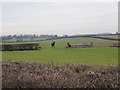
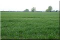
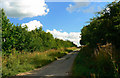
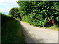
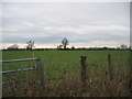
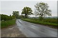
Siddington is a civil parish covering an area of 8.5 km² in England. Living in Siddington offers a space that accommodates residents within a compact, defined boundary. The settlement functions as a self-contained community where daily life revolves around the local parish centre. You will find a residence in a village that maintains a traditional scale while providing essential access to regional amenities. The total area size suggests a low-density environment suitable for those seeking a quiet lifestyle without urban congestion. Homes in Siddington sit within this specific footprint, offering a sense of place that contrasts with larger towns. Residents enjoy a neighbourhood character shaped by its historical roots and geographical limits. You can experience a living environment where the scale of the village remains distinct and manageable. The area provides a stable foundation for family life or retirement, anchored by its status as a recognised civil parish. This setting allows you to connect with local history while maintaining privacy within your home.
- Area Type
- Parish
- Area Size
- 8.5 km²
- Population
- Not available
- Population Density
- Not available
Demographics
The community in Siddington reflects a mature population structure with a median age of 70. Living in Siddington means residing in an area where older adults form the dominant demographic group. This age profile indicates a settlement built around retirees and long-term residents rather than young families or commuters. House ownership stands at 65%, which is a significant portion of the total households. This high rate of owner occupancy suggests stability within the neighbourhood and a commitment to the location by current occupants. The household composition data covers the total population, confirming the broad demographic spread across the village. Somerset, which is the administrative quarter, encompasses this parish, providing a wider administrative context for local governance. You will find that the ethnic diversity and religious demographics reflect the total population statistics recorded for the region. The lack of specific breakdowns for these categories highlights the homogenous nature of the settlement. These figures paint a picture of a quiet, established community where life pace aligns with the needs of an older resident base.
Household Size
Accommodation Type
Tenure
Ethnic Group
Religion
Household Composition
Age
Household Deprivation
NS-SEC
Explore more demographic insights in this area
Go to Demographics tabPlanning
Planning Constraints
- Flood RiskPremium
- Ramsar Wetland SitesPremium
- Area of Outstanding Natural BeautyPremium
- Protected Nature ReservePremium
- Protected WoodlandPremium
- Crime RiskPremium