Area Overview for Prestbury
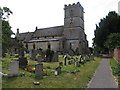
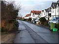
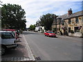
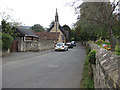
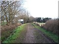
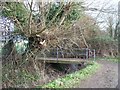
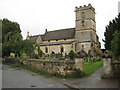
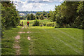
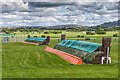
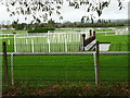
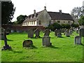
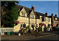
Photos of Prestbury
Area Information
Prestbury is a compact civil parish covering an area of 4.5 km². This small footprint means the neighbourhood feels contained and manageable for residents. Living in Prestbury involves navigating a space that prioritises established character over rapid expansion. The layout supports a quiet daily life where distance to amenities is typically short. You will find a setting defined by its tight geographic bounds, which fosters an intimate sense of community. The environment lacks the sprawl of larger towns, concentrating activity within a defined perimeter. Your day to day existence here revolves around a localised network of services and green spaces. The limited size ensures that you do not need long commutes to reach the edges of the parish. This proximity creates a distinct rhythm to life in the area. Residents enjoy a settled lifestyle where the boundaries are clear. The parish stands as a self-contained entity within the wider region. You gain access to a complete local environment without the need to travel far. Every aspect of daily living in Prestbury benefits from this geographical concentration. The result is a neighbourhood where the scale remains consistent and familiar.
- Area Type
- Parish
- Area Size
- 4.5 km²
- Population
- Not available
- Population Density
- Not available
Demographics
The community in Prestbury displays a clear age profile with a median age of 70. This figure indicates that the population skews significantly toward older residents. You are likely to find a neighbourhood where many inhabitants have lived there for decades. The high home ownership rate of 85% reinforces this pattern of long-term residency. Most households in Prestbury consist of owners rather than tenants or investors. This stability shapes the social fabric of the area. Accommodation types and household compositions reflect the needs of an established, mature population. The diversity of ethnic groups and religious affiliations forms part of the local identity without being explicitly detailed in the available figures. You can expect a homogenous demographic in terms of age but a stable residential base in terms of tenure. The area does not rely on large numbers of commuters or young families in the same way as other town centres. Instead, it serves as a retirement or semi-retirement location. This demographic reality influences local services and facilities. When you think about living here, consider that the average neighbour will be older. The 85% ownership figure means you will encounter many people with deep roots in the parish.
Household Size
Accommodation Type
Tenure
Ethnic Group
Religion
Household Composition
Age
Household Deprivation
NS-SEC
Explore more demographic insights in this area
Go to Demographics tabPlanning
Planning Constraints
- Flood RiskPremium
- Ramsar Wetland SitesPremium
- Area of Outstanding Natural BeautyPremium
- Protected Nature ReservePremium
- Protected WoodlandPremium