Area Overview for GL54 2EY
Photos of GL54 2EY

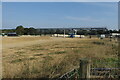
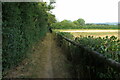
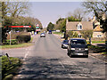
27 photos from this area
Area Information
Key information about the GL54 2EY including its size, population, and administrative classification.
- Area Type
- Postcode
- Area Size
- 63.5 hectares
- Population
- 1912
- Population Density
- 20 people/km²
House Prices in GL54 2EY
15
Properties
£458,833
Average Sold Price
£215,000
Lowest Price
£753,000
Highest Price
Showing 15 properties
| Address | Type | Beds | Baths | Last Sale Price | Last Sale Date | |
|---|---|---|---|---|---|---|
| Stonesthrow, Fosseway, Lower Slaughter, GL54 2EY | Land | 3 | 2 | £753,000 | Dec 2023 | |
| Lakeside, Fosseway, Lower Slaughter, GL54 2EY | Semi-detached | 1 | 1 | £465,000 | Aug 2023 | |
| The Nook, Fosseway, Lower Slaughter, GL54 2EY | storage_distribution | - | - | £700,000 | Jun 2023 | |
| Homestead, Fosseway, Lower Slaughter, GL54 2EY | house | 1 | 1 | £400,000 | Jan 2022 | |
| 2, Fosseway Terrace, Fosseway, Lower Slaughter, GL54 2EY | house | 3 | - | £220,000 | Apr 2021 | |
| Pike House, Fosseway, Lower Slaughter, GL54 2EY | Detached | 3 | 1 | £215,000 | Mar 2004 | |
| Annexe, Westwood, Fosseway, Lower Slaughter, GL54 2EY | Detached | 6 | 8 | - | - | |
| Westwood, Fosseway, Lower Slaughter, GL54 2EY | house | 5 | 4 | - | - | |
| Bence Roofing Supplies Ltd, Bence Roofing Supplies, Fosseway, Lower Slaughter, GL54 2EY | office_workshop | - | - | - | - | |
| Dikler Farm, Fosseway, Lower Slaughter, GL54 2EY | Farm | - | - | - | - |
Page 1 of 2
Energy Efficiency in GL54 2EY
Amenities
Schools
| Rank | School | Type | Entry gender | Ages |
|---|
Explore more schools in this area
Go to Schools tabDemographics
Household Size
Two person
most common
Accommodation Type
Houses
most common
Tenure
62
majority
Ethnic Group
White
most common
Religion
N/A
most common
Household Composition
N/A
most common
Age
47
median
Adults (30-64 years)
most common
Household Deprivation
N/A
with no deprivation
NS-SEC
44
in Lower managerial occupations
Explore more demographic insights in this area
Go to Demographics tabPlanning
Planning Constraints
- Flood RiskPremium
- Ramsar Wetland SitesPremium
- Area of Outstanding Natural BeautyPremium
- Protected Nature ReservePremium
- Protected WoodlandPremium