Area Overview for GL54 2EZ
Photos of GL54 2EZ


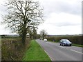
![Across the dismantled railway [1] in GL54 2EZ](https://images.propbar.co.uk/images/geograph/16/25/1625057_120.jpg)


25 photos from this area
Area Information
Key information about the GL54 2EZ including its size, population, and administrative classification.
- Area Type
- Postcode
- Area Size
- 1.5 km²
- Population
- 1301
- Population Density
- 37 people/km²
House Prices in GL54 2EZ
11
Properties
£100,000
Average Sold Price
£100,000
Lowest Price
£100,000
Highest Price
Showing 11 properties
| Address | Type | Beds | Baths | Last Sale Price | Last Sale Date | |
|---|---|---|---|---|---|---|
| Ourome, Stow Road, Bourton On The Water, GL54 2EZ | Detached | - | - | £100,000 | Jul 2005 | |
| 1, Meadow Farm Cottages, Fosseway, Stow On The Wold, GL54 2EZ | house | - | - | - | - | |
| Meadow View, Stow Road, Bourton On The Water, GL54 2EZ | Land | - | - | - | - | |
| Heath Hill Farm, Stow Road, Bourton On The Water, GL54 2EZ | house | - | - | - | - | |
| Toddington Garden Centre, B 4077 The Pheasant Inn Stanway To War Memorial, Stanway, Tewkesbury, GL54 2EZ | shop | - | - | - | - | |
| 1, Heath Hill Cottages, Stow Road, Bourton On The Water, GL54 2EZ | Semi-detached | - | - | - | - | |
| 2, Heath Hill Cottages, Stow Road, Bourton On The Water, GL54 2EZ | Semi-detached | - | - | - | - | |
| Heath Hill Bungalow, Stow Road, Bourton On The Water, GL54 2EZ | Bungalow | - | - | - | - | |
| Annexe, Ourome, Stow Road, Bourton On The Water, GL54 2EZ | Flat | - | - | - | - | |
| Mobile Home, Land Parcel South Of Meadow View, Stow Road, Bourton On The Water, GL54 2EZ | Mobile Home | - | - | - | - |
Page 1 of 2
Energy Efficiency in GL54 2EZ
Amenities
Schools
| Rank | School | Type | Entry gender | Ages |
|---|
Explore more schools in this area
Go to Schools tabDemographics
Household Size
Two person
most common
Accommodation Type
Houses
most common
Tenure
71
majority
Ethnic Group
White
most common
Religion
N/A
most common
Household Composition
N/A
most common
Age
47
median
Adults (30-64 years)
most common
Household Deprivation
N/A
with no deprivation
NS-SEC
42
in Lower managerial occupations
Explore more demographic insights in this area
Go to Demographics tabPlanning
Planning Constraints
- Flood RiskPremium
- Ramsar Wetland SitesPremium
- Area of Outstanding Natural BeautyPremium
- Protected Nature ReservePremium
- Protected WoodlandPremium