Area Overview for GL54 1EG
Photos of GL54 1EG

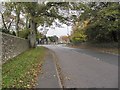
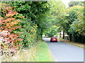
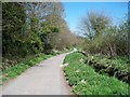

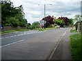
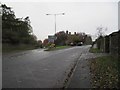
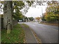
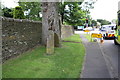
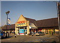
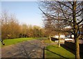
63 photos from this area
Area Information
Key information about the GL54 1EG including its size, population, and administrative classification.
- Area Type
- Postcode
- Area Size
- 56.3 hectares
- Population
- 1792
- Population Density
- 28 people/km²
House Prices in GL54 1EG
23
Properties
£418,125
Average Sold Price
£46,000
Lowest Price
£1,125,000
Highest Price
Showing 23 properties
| Address | Type | Beds | Baths | Last Sale Price | Last Sale Date | |
|---|---|---|---|---|---|---|
| My Cottage, Moreton Road, Stow On The Wold, GL54 1EG | Cottage | 2 | 1 | £275,000 | Aug 2020 | |
| The Paddocks, Moreton Road, Stow On The Wold, GL54 1EG | Detached | 4 | 3 | £1,125,000 | Jun 2017 | |
| Badgers End, Moreton Road, Stow On The Wold, GL54 1EG | Terraced | 3 | 3 | £393,000 | May 2017 | |
| Pingle House, Moreton Road, Stow On The Wold, GL54 1EG | Detached | - | - | £665,000 | May 2015 | |
| Grove House, Moreton Road, Stow On The Wold, GL54 1EG | Detached | 4 | - | £620,000 | Apr 2015 | |
| Pitts Barn, Moreton Road, Stow On The Wold, GL54 1EG | house | - | - | £460,000 | Jan 2013 | |
| Hillbarn, Moreton Road, Stow On The Wold, GL54 1EG | Detached | 6 | 5 | £430,000 | Sep 2012 | |
| School House, Moreton Road, Stow On The Wold, GL54 1EG | house | 3 | - | £350,000 | Aug 2010 | |
| Finchley House, Moreton Road, Stow On The Wold, GL54 1EG | house | 5 | - | £975,000 | Jul 2010 | |
| Primrose Cottage, Moreton Road, Stow On The Wold, GL54 1EG | Terraced | 3 | 2 | £365,000 | Jun 2008 |
Page 1 of 3
Energy Efficiency in GL54 1EG
Amenities
Schools
| Rank | School | Type | Entry gender | Ages |
|---|
Explore more schools in this area
Go to Schools tabDemographics
Household Size
Two person
most common
Accommodation Type
Houses
most common
Tenure
61
majority
Ethnic Group
White
most common
Religion
N/A
most common
Household Composition
N/A
most common
Age
47
median
Adults (30-64 years)
most common
Household Deprivation
N/A
with no deprivation
NS-SEC
41
in Lower managerial occupations
Explore more demographic insights in this area
Go to Demographics tabPlanning
Planning Constraints
- Flood RiskPremium
- Ramsar Wetland SitesPremium
- Area of Outstanding Natural BeautyPremium
- Protected Nature ReservePremium
- Protected WoodlandPremium