Area Overview for GL53 7BH
Photos of GL53 7BH
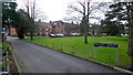
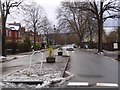
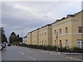
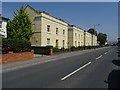
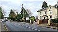
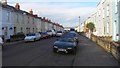
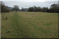
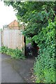
45 photos from this area
Area Information
Key information about the GL53 7BH including its size, population, and administrative classification.
- Area Type
- Postcode
- Area Size
- 7960 m²
- Population
- 1480
- Population Density
- 3828 people/km²
House Prices in GL53 7BH
34
Properties
£292,838
Average Sold Price
£90,000
Lowest Price
£700,000
Highest Price
Showing 34 properties
| Address | Type | Beds | Baths | Last Sale Price | Last Sale Date | |
|---|---|---|---|---|---|---|
| 46 Naunton Lane, Cheltenham, GL53 7BH | Terraced | 2 | 1 | £390,000 | Jul 2025 | |
| 58 Naunton Lane, Cheltenham, GL53 7BH | Semi-detached | 4 | 2 | £700,000 | Sep 2023 | |
| 30 Naunton Lane, Cheltenham, GL53 7BH | Terraced | 2 | 1 | £365,000 | Aug 2023 | |
| 52 Naunton Lane, Cheltenham, GL53 7BH | house | - | - | £442,500 | Feb 2023 | |
| 6 NAUNTON LANE, Cheltenham, GL53 7BH | Terraced | 2 | 1 | £350,000 | Dec 2022 | |
| 60 Naunton Lane, Cheltenham, GL53 7BH | house | - | - | £600,000 | Jul 2022 | |
| 32 Naunton Lane, Cheltenham, GL53 7BH | Terraced | 2 | 2 | £350,000 | Jun 2022 | |
| 40 Naunton Lane, Cheltenham, GL53 7BH | house | - | - | £335,000 | Jan 2022 | |
| 28 Naunton Lane, Cheltenham, GL53 7BH | Terraced | 2 | 1 | £335,000 | Aug 2021 | |
| 34 Naunton Lane, Cheltenham, GL53 7BH | Terraced | 2 | 1 | £305,000 | Apr 2018 |
Page 1 of 4
Energy Efficiency in GL53 7BH
Amenities
Schools
| Rank | School | Type | Entry gender | Ages |
|---|
Explore more schools in this area
Go to Schools tabDemographics
Household Size
Family (3-5 people)
most common
Accommodation Type
Houses
most common
Tenure
82
majority
Ethnic Group
White
most common
Religion
N/A
most common
Household Composition
N/A
most common
Age
47
median
Adults (30-64 years)
most common
Household Deprivation
N/A
with no deprivation
NS-SEC
59
in Lower managerial occupations
Explore more demographic insights in this area
Go to Demographics tabPlanning
Planning Constraints
- Flood RiskPremium
- Ramsar Wetland SitesPremium
- Area of Outstanding Natural BeautyPremium
- Protected Nature ReservePremium
- Protected WoodlandPremium