Area Overview for GL52 9RB
Photos of GL52 9RB
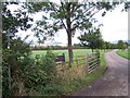


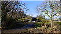
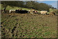
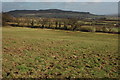
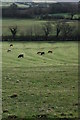
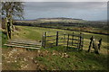

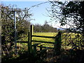
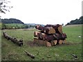
12 photos from this area
Area Information
Key information about the GL52 9RB including its size, population, and administrative classification.
- Area Type
- Postcode
- Area Size
- 2.6 km²
- Population
- 1785
- Population Density
- 79 people/km²
House Prices in GL52 9RB
16
Properties
£1,580,000
Average Sold Price
£1,175,000
Lowest Price
£1,985,000
Highest Price
Showing 16 properties
| Address | Type | Beds | Baths | Last Sale Price | Last Sale Date | |
|---|---|---|---|---|---|---|
| Latitude, Dixton, Gotherington, Cheltenham, GL52 9RB | Detached | 4 | 3 | £1,985,000 | Jan 2018 | |
| Hunters Moon, Dixton, Gotherington, Cheltenham, GL52 9RB | house | - | - | £1,175,000 | Sep 2017 | |
| Dixton Manor, Dixton, Gotherington, Cheltenham, GL52 9RB | Detached | 5 | 2 | - | - | |
| Formerly Black Barn Farm, Dixton, Gotherington, Cheltenham, GL52 9RB | Detached | - | - | - | - | |
| Covered Cattle Shed, Dixton, Gotherington, Cheltenham, GL52 9RB | Farm | - | - | - | - | |
| Grain Store, Dixton, Gotherington, Cheltenham, GL52 9RB | Farm | - | - | - | - | |
| The Barn, Dixton, Gotherington, Cheltenham, GL52 9RB | Semi-detached | - | - | - | - | |
| Black Barn Farm, Dixton, Gotherington, Cheltenham, GL52 9RB | house | - | - | - | - | |
| Manor Fam Cottages, Dixton, Gotherington, Cheltenham, GL52 9RB | Terraced | - | - | - | - | |
| Severn Trent Covered Reservoir, Dixton, Gotherington, Cheltenham, GL52 9RB | Industrial | - | - | - | - |
Page 1 of 2
Energy Efficiency in GL52 9RB
Amenities
Schools
| Rank | School | Type | Entry gender | Ages |
|---|
Explore more schools in this area
Go to Schools tabDemographics
Household Size
Two person
most common
Accommodation Type
Houses
most common
Tenure
84
majority
Ethnic Group
White
most common
Religion
N/A
most common
Household Composition
N/A
most common
Age
47
median
Adults (30-64 years)
most common
Household Deprivation
N/A
with no deprivation
NS-SEC
47
in Lower managerial occupations
Explore more demographic insights in this area
Go to Demographics tabPlanning
Planning Constraints
- Flood RiskPremium
- Ramsar Wetland SitesPremium
- Area of Outstanding Natural BeautyPremium
- Protected Nature ReservePremium
- Protected WoodlandPremium