Area Overview for GL52 9QY
Photos of GL52 9QY
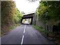
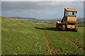

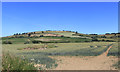
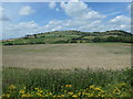

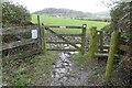
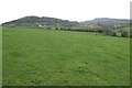
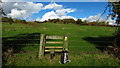
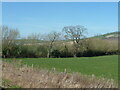
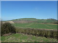
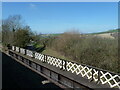
36 photos from this area
Area Information
Key information about the GL52 9QY including its size, population, and administrative classification.
- Area Type
- Postcode
- Area Size
- 51.8 hectares
- Population
- 2401
- Population Density
- 98 people/km²
House Prices in GL52 9QY
17
Properties
£608,000
Average Sold Price
£250,000
Lowest Price
£927,000
Highest Price
Showing 17 properties
| Address | Type | Beds | Baths | Last Sale Price | Last Sale Date | |
|---|---|---|---|---|---|---|
| Sleepers, Gretton Road, Gotherington, Cheltenham, GL52 9QY | Bungalow | 3 | 2 | £647,000 | Feb 2024 | |
| The Folly, Gretton Road, Gotherington, Cheltenham, GL52 9QY | Semi-detached | - | - | £927,000 | Nov 2021 | |
| The Knolls, Gretton Road, Gotherington, Cheltenham, GL52 9QY | house | - | - | £250,000 | Mar 2011 | |
| Meadoways, Gretton Road, Gotherington, Cheltenham, GL52 9QY | Semi-detached | 4 | 1 | - | - | |
| Parcel 6918 And 4621 And 7438, Gretton Road, Gotherington, Cheltenham, GL52 9QY | Detached | - | - | - | - | |
| Parcel 0520, Gretton Road, Gotherington, Cheltenham, GL52 9QY | Detached | - | - | - | - | |
| 1, Station Cottages, Gretton Road, Gotherington, Cheltenham, GL52 9QY | Bungalow | - | - | - | - | |
| 2, Station Cottages, Gretton Road, Gotherington, Cheltenham, GL52 9QY | Semi-detached | - | - | - | - | |
| Station Cottage, Gretton Road, Gotherington, Cheltenham, GL52 9QY | Semi-detached | - | - | - | - | |
| Meadoway, Gretton Road, Gotherington, Cheltenham, GL52 9QY | Detached | - | - | - | - |
Page 1 of 2
Energy Efficiency in GL52 9QY
Amenities
Schools
| Rank | School | Type | Entry gender | Ages |
|---|
Explore more schools in this area
Go to Schools tabDemographics
Household Size
Two person
most common
Accommodation Type
Houses
most common
Tenure
86
majority
Ethnic Group
White
most common
Religion
N/A
most common
Household Composition
N/A
most common
Age
47
median
Adults (30-64 years)
most common
Household Deprivation
N/A
with no deprivation
NS-SEC
49
in Lower managerial occupations
Explore more demographic insights in this area
Go to Demographics tabPlanning
Planning Constraints
- Flood RiskPremium
- Ramsar Wetland SitesPremium
- Area of Outstanding Natural BeautyPremium
- Protected Nature ReservePremium
- Protected WoodlandPremium