Area Overview for GL51 0QT
Photos of GL51 0QT
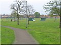
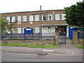
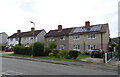
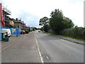
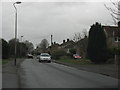
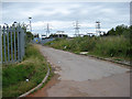
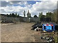
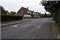
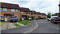
9 photos from this area
Area Information
Key information about the GL51 0QT including its size, population, and administrative classification.
- Area Type
- Postcode
- Area Size
- 7997 m²
- Population
- 1583
- Population Density
- 2800 people/km²
House Prices in GL51 0QT
27
Properties
£135,180
Average Sold Price
£46,000
Lowest Price
£235,000
Highest Price
Showing 27 properties
| Address | Type | Beds | Baths | Last Sale Price | Last Sale Date | |
|---|---|---|---|---|---|---|
| 19 Dunster Gardens, Cheltenham, GL51 0QT | Terraced | 2 | 1 | £230,000 | Feb 2025 | |
| 21 Dunster Gardens, Cheltenham, GL51 0QT | Terraced | 2 | 1 | £230,000 | Dec 2024 | |
| Davross, 14 Dunster Gardens, Cheltenham, GL51 0QT | house | - | - | £230,500 | Jul 2022 | |
| 3 Dunster Gardens, Cheltenham, GL51 0QT | house | - | - | £235,000 | Jun 2021 | |
| 9 Dunster Gardens, Cheltenham, GL51 0QT | house | 2 | - | £165,000 | May 2021 | |
| 20 Dunster Gardens, Cheltenham, GL51 0QT | Semi-detached | 2 | 1 | £161,000 | Mar 2018 | |
| 25 Dunster Gardens, Cheltenham, GL51 0QT | Terraced | 2 | 1 | £162,000 | Feb 2018 | |
| 23 Dunster Gardens, Cheltenham, GL51 0QT | Terraced | 2 | 1 | £162,500 | Dec 2016 | |
| 15 Dunster Gardens, Cheltenham, GL51 0QT | house | 2 | 1 | £145,000 | Aug 2014 | |
| 6 Dunster Gardens, Cheltenham, GL51 0QT | Semi-detached | 3 | 1 | £155,000 | Feb 2014 |
Page 1 of 3
Energy Efficiency in GL51 0QT
Amenities
Schools
| Rank | School | Type | Entry gender | Ages |
|---|
Explore more schools in this area
Go to Schools tabDemographics
Household Size
Two person
most common
Accommodation Type
Houses
most common
Tenure
76
majority
Ethnic Group
White
most common
Religion
N/A
most common
Household Composition
N/A
most common
Age
47
median
Adults (30-64 years)
most common
Household Deprivation
N/A
with no deprivation
NS-SEC
26
in Lower managerial occupations
Explore more demographic insights in this area
Go to Demographics tabPlanning
Planning Constraints
- Flood RiskPremium
- Ramsar Wetland SitesPremium
- Area of Outstanding Natural BeautyPremium
- Protected Nature ReservePremium
- Protected WoodlandPremium