Area Overview for GL51 0SD
Photos of GL51 0SD
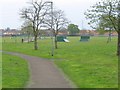
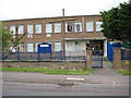
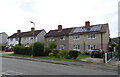
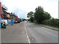
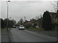
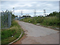
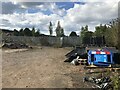
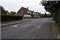
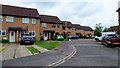
9 photos from this area
Area Information
Key information about the GL51 0SD including its size, population, and administrative classification.
- Area Type
- Postcode
- Area Size
- 6444 m²
- Population
- 1583
- Population Density
- 2800 people/km²
House Prices in GL51 0SD
16
Properties
£166,719
Average Sold Price
£89,950
Lowest Price
£210,000
Highest Price
Showing 16 properties
| Address | Type | Beds | Baths | Last Sale Price | Last Sale Date | |
|---|---|---|---|---|---|---|
| 147 Hesters Way Road, Cheltenham, GL51 0SD | house | 3 | - | £210,000 | Oct 2020 | |
| 131 Hesters Way Road, Cheltenham, GL51 0SD | Semi-detached | 3 | - | £187,500 | Jun 2020 | |
| 151 Hesters Way Road, Cheltenham, GL51 0SD | Semi-detached | 2 | 1 | £168,000 | Oct 2019 | |
| 159 Hesters Way Road, Cheltenham, GL51 0SD | Semi-detached | 3 | 1 | £210,000 | Jul 2018 | |
| 139 Hesters Way Road, Cheltenham, GL51 0SD | Semi-detached | 3 | - | £175,000 | Apr 2017 | |
| 137 Hesters Way Road, Cheltenham, GL51 0SD | house | 3 | 1 | £190,000 | Dec 2016 | |
| 157 Hesters Way Road, Cheltenham, GL51 0SD | Semi-detached | 3 | 1 | £187,950 | Jan 2016 | |
| 143 Hesters Way Road, Cheltenham, GL51 0SD | Bungalow | 3 | 2 | £175,000 | Apr 2015 | |
| 153 Hesters Way Road, Cheltenham, GL51 0SD | Semi-detached | 4 | - | £155,000 | Jun 2014 | |
| 129 Hesters Way Road, Cheltenham, GL51 0SD | Semi-detached | 3 | 1 | £105,000 | Sep 2012 |
Page 1 of 2
Energy Efficiency in GL51 0SD
Amenities
Schools
| Rank | School | Type | Entry gender | Ages |
|---|
Explore more schools in this area
Go to Schools tabDemographics
Household Size
Two person
most common
Accommodation Type
Houses
most common
Tenure
76
majority
Ethnic Group
White
most common
Religion
N/A
most common
Household Composition
N/A
most common
Age
47
median
Adults (30-64 years)
most common
Household Deprivation
N/A
with no deprivation
NS-SEC
26
in Lower managerial occupations
Explore more demographic insights in this area
Go to Demographics tabPlanning
Planning Constraints
- Flood RiskPremium
- Ramsar Wetland SitesPremium
- Area of Outstanding Natural BeautyPremium
- Protected Nature ReservePremium
- Protected WoodlandPremium