Area Overview for GL50 4PH
Photos of GL50 4PH

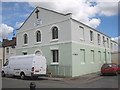
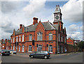
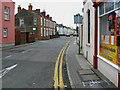
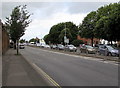

86 photos from this area
Area Information
Key information about the GL50 4PH including its size, population, and administrative classification.
- Area Type
- Postcode
- Area Size
- 8322 m²
- Population
- 1881
- Population Density
- 2450 people/km²
House Prices in GL50 4PH
21
Properties
£211,657
Average Sold Price
£64,000
Lowest Price
£425,000
Highest Price
Showing 21 properties
| Address | Type | Beds | Baths | Last Sale Price | Last Sale Date | |
|---|---|---|---|---|---|---|
| 47 Albemarle Gate, Cheltenham, GL50 4PH | Semi-detached | 3 | 1 | £415,000 | Aug 2023 | |
| 45 Albemarle Gate, Cheltenham, GL50 4PH | house | - | - | £425,000 | Aug 2022 | |
| 49 Albemarle Gate, Cheltenham, GL50 4PH | house | - | - | £360,000 | Feb 2021 | |
| 51 Albemarle Gate, Cheltenham, GL50 4PH | house | - | - | £312,500 | May 2019 | |
| 53 Albemarle Gate, Cheltenham, GL50 4PH | house | - | - | £340,000 | Jan 2017 | |
| 63 Albemarle Gate, Cheltenham, GL50 4PH | Semi-detached | 3 | - | £230,000 | Jan 2010 | |
| 71 Albemarle Gate, Cheltenham, GL50 4PH | Semi-detached | - | - | £241,000 | Sep 2007 | |
| 39 Albemarle Gate, Cheltenham, GL50 4PH | Semi-detached | - | - | £192,000 | Jul 2003 | |
| 43 Albemarle Gate, Cheltenham, GL50 4PH | Semi-detached | 3 | 1 | £179,000 | Sep 2002 | |
| 37 Albemarle Gate, Cheltenham, GL50 4PH | Semi-detached | 3 | 1 | £115,000 | Mar 2000 |
Page 1 of 3
Energy Efficiency in GL50 4PH
Amenities
Schools
| Rank | School | Type | Entry gender | Ages |
|---|
Explore more schools in this area
Go to Schools tabDemographics
Household Size
Two person
most common
Accommodation Type
Houses
most common
Tenure
80
majority
Ethnic Group
White
most common
Religion
N/A
most common
Household Composition
N/A
most common
Age
47
median
Adults (30-64 years)
most common
Household Deprivation
N/A
with no deprivation
NS-SEC
38
in Lower managerial occupations
Explore more demographic insights in this area
Go to Demographics tabPlanning
Planning Constraints
- Flood RiskPremium
- Ramsar Wetland SitesPremium
- Area of Outstanding Natural BeautyPremium
- Protected Nature ReservePremium
- Protected WoodlandPremium