Area Overview for GL17 9UB
Photos of GL17 9UB
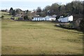
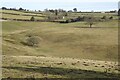
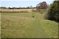
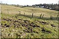
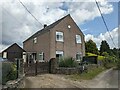
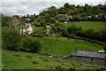
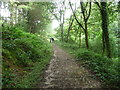
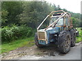
29 photos from this area
Area Information
Key information about the GL17 9UB including its size, population, and administrative classification.
- Area Type
- Postcode
- Area Size
- 10.8 hectares
- Population
- 1813
- Population Density
- 262 people/km²
House Prices in GL17 9UB
18
Properties
£268,786
Average Sold Price
£156,500
Lowest Price
£385,000
Highest Price
Showing 18 properties
| Address | Type | Beds | Baths | Last Sale Price | Last Sale Date | |
|---|---|---|---|---|---|---|
| The White House, Newham Bottom, Ruardean Woodside, GL17 9UB | Cottage | 2 | 1 | £385,000 | Mar 2025 | |
| Rock House, Newham Bottom, Ruardean Woodside, GL17 9UB | Cottage | 3 | 1 | £340,000 | Dec 2018 | |
| 2, New House, Newham Bottom, Ruardean Woodside, GL17 9UB | house | - | - | £250,000 | Mar 2018 | |
| Snowdrop Cottage, Newham Bottom, Ruardean Woodside, GL17 9UB | Cottage | 2 | 1 | £250,000 | Jul 2012 | |
| The Old School House, Newham Bottom, Ruardean Woodside, GL17 9UB | Detached | 3 | 3 | £235,000 | Jun 2004 | |
| Snow Goose Cottage, Newham Bottom, Ruardean Woodside, GL17 9UB | Detached | - | - | £265,000 | Apr 2004 | |
| The Old Shop, Newham Bottom, Ruardean Woodside, GL17 9UB | Cottage | 3 | 2 | £156,500 | May 2000 | |
| 1, New House, Newham Bottom, Ruardean Woodside, GL17 9UB | Equestrian | 3 | 1 | - | - | |
| The Cottage, Newham Bottom, Ruardean Woodside, GL17 9UB | Cottage | 3 | 1 | - | - | |
| 1, Woodland View, The Cottages, Newham Bottom, Ruardean Woodside, GL17 9UB | Semi-detached | 2 | 1 | - | - |
Page 1 of 2
Energy Efficiency in GL17 9UB
Amenities
Schools
| Rank | School | Type | Entry gender | Ages |
|---|
Explore more schools in this area
Go to Schools tabDemographics
Household Size
Two person
most common
Accommodation Type
Houses
most common
Tenure
89
majority
Ethnic Group
White
most common
Religion
N/A
most common
Household Composition
N/A
most common
Age
47
median
Adults (30-64 years)
most common
Household Deprivation
N/A
with no deprivation
NS-SEC
33
in Lower managerial occupations
Explore more demographic insights in this area
Go to Demographics tabPlanning
Planning Constraints
- Flood RiskPremium
- Ramsar Wetland SitesPremium
- Area of Outstanding Natural BeautyPremium
- Protected Nature ReservePremium
- Protected WoodlandPremium