Area Overview for GL17 9YH
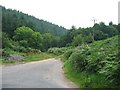
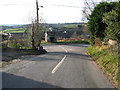
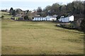
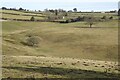
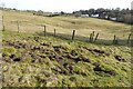
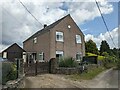
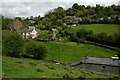
Photos of GL17 9YH


Area Information
Living in GL17 9YH means being part of a small, tightly knit residential cluster in England, where 1,813 residents share a population density of 262 people per square kilometre. This is a community defined by stability, with 89% of homes owner-occupied and predominantly houses rather than flats. The area’s character is shaped by its mature demographic, with a median age of 47 and most residents falling within the 30–64 age range. Daily life here balances quiet living with access to nearby amenities, from local shops to rail connections. The postcode’s compact size means it feels intimate, yet it is served by key infrastructure such as Woodside Primary School and a network of retail and transport links. For those seeking a settled, low-maintenance lifestyle without sacrificing convenience, GL17 9YH offers a blend of practicality and community focus. Its proximity to retail hubs like Co-op Drybrook and Lidl Cinderford, combined with low crime rates, makes it appealing for families and individuals alike.
- Area Type
- Postcode
- Area Size
- Not available
- Population
- 1813
- Population Density
- 262 people/km²
The property market in GL17 9YH is dominated by owner-occupied homes, with 89% of properties owned by residents rather than rented. This high rate of home ownership reflects a community prioritising long-term investment and stability. The accommodation type is predominantly houses, which is typical for areas with older, established populations. Given the small size of the postcode and its focus on residential housing, the market is likely limited in scale but characterised by a consistent supply of family homes. Buyers considering this area should note that the housing stock is not geared towards rental or short-term lettings, making it a more predictable market for those seeking a permanent residence. The lack of flats or newer developments suggests a conservative, low-turnover environment where properties may retain value over time.
House Prices in GL17 9YH
No properties found in this postcode.
Energy Efficiency in GL17 9YH
Residents of GL17 9YH have access to a range of nearby amenities that support everyday living. The area is served by five retail outlets, including Co-op Drybrook, Co-op Valley, and Lidl Cinderford, providing essential shopping and grocery options. These local stores contribute to the convenience of daily life, reducing the need for long commutes to larger centres. The presence of two metro stations, Dean Forest Railway and Parkend, adds to the area’s accessibility, though the specific routes and connections are not detailed. For leisure and transport, the Dean Forest Railway may offer a scenic or practical alternative to road travel. The combination of retail options and transport links ensures that residents can manage routine tasks and travel with relative ease.
Amenities
Schools
The nearest school to GL17 9YH is Woodside Primary School, which serves the area with a good Ofsted rating. This indicates a reliable foundation for early education, though no secondary schools are listed in the data. The presence of a primary school with a positive rating is a key consideration for families with young children, offering a locally accessible option for education. The absence of higher-tier schools nearby means that students may need to travel further for secondary education, but the quality of primary schooling suggests a strong start to academic development. For families prioritising immediate educational needs, Woodside Primary School provides a solid resource within the community.
| Rank | School | Type | Entry gender | Ages |
|---|
Explore more schools in this area
Go to Schools tabDemographics
The community in GL17 9YH is predominantly composed of adults aged 30–64, with a median age of 47. This suggests a population skewed towards middle-aged individuals, likely including families and professionals. Home ownership is exceptionally high at 89%, indicating a strong preference for long-term residency over rental properties. The area is characterised by houses rather than flats, which aligns with the demographic profile of older, established residents. The predominant ethnic group is White, though no specific data on diversity or deprivation is provided. This age group and ownership pattern suggest a community with a focus on stability and continuity. The absence of detailed diversity metrics means the area’s cultural composition remains less defined in the data, but the high home ownership and age profile point to a relatively uniform social fabric.
Household Size
Accommodation Type
Tenure
Ethnic Group
Religion
Household Composition
Age
Household Deprivation
NS-SEC
Explore more demographic insights in this area
Go to Demographics tabPlanning
Planning Constraints
- Flood RiskPremium
- Ramsar Wetland SitesPremium
- Area of Outstanding Natural BeautyPremium
- Protected Nature ReservePremium
- Protected WoodlandPremium