Area Overview for GL17 0RA
Photos of GL17 0RA
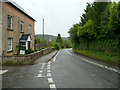
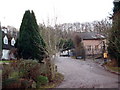
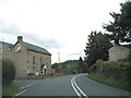
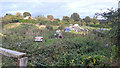
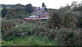
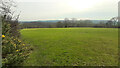
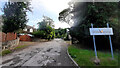

46 photos from this area
Area Information
Key information about the GL17 0RA including its size, population, and administrative classification.
- Area Type
- Postcode
- Area Size
- 61.7 hectares
- Population
- 1817
- Population Density
- 90 people/km²
House Prices in GL17 0RA
13
Properties
£403,039
Average Sold Price
£381,077
Lowest Price
£425,000
Highest Price
Showing 13 properties
| Address | Type | Beds | Baths | Last Sale Price | Last Sale Date | |
|---|---|---|---|---|---|---|
| Hop House, Gloucester Road, Longhope, GL17 0RA | Detached | - | - | £381,077 | Feb 2020 | |
| The Woodlands, Gloucester Road, Longhope, GL17 0RA | house | - | - | £425,000 | Jun 2014 | |
| Dursley Cross Farm, A 40 From Gloucester Road To Ross Road, Dursley Cross, Longhope, GL17 0RA | Detached | 7 | 5 | - | - | |
| The Annexe, Jordan House, Gloucester Road, Longhope, GL17 0RA | house | - | - | - | - | |
| The Annexe, Dursley Cross Farm, A 40 From Gloucester Road To Ross Road, Dursley Cross, Longhope, GL17 0RA | house | - | - | - | - | |
| Spring Fields, Gloucester Road, Longhope, GL17 0RA | Detached | - | - | - | - | |
| Willow Lodge, Gloucester Road, Longhope, GL17 0RA | Detached | - | - | - | - | |
| Sunnymeade, Gloucester Road, Longhope, GL17 0RA | Bungalow | - | - | - | - | |
| Jordan House, Gloucester Road, Longhope, GL17 0RA | Detached | - | - | - | - | |
| Sheperdine Farm, Gloucester Road, Longhope, GL17 0RA | Detached | - | - | - | - |
Page 1 of 2
Energy Efficiency in GL17 0RA
Amenities
Schools
| Rank | School | Type | Entry gender | Ages |
|---|
Explore more schools in this area
Go to Schools tabDemographics
Household Size
Two person
most common
Accommodation Type
Houses
most common
Tenure
86
majority
Ethnic Group
White
most common
Religion
N/A
most common
Household Composition
N/A
most common
Age
47
median
Adults (30-64 years)
most common
Household Deprivation
N/A
with no deprivation
NS-SEC
37
in Lower managerial occupations
Explore more demographic insights in this area
Go to Demographics tabPlanning
Planning Constraints
- Flood RiskPremium
- Ramsar Wetland SitesPremium
- Area of Outstanding Natural BeautyPremium
- Protected Nature ReservePremium
- Protected WoodlandPremium