Area Overview for GL14 3AW
Photos of GL14 3AW
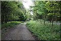
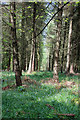
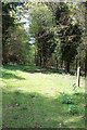
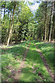
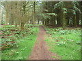
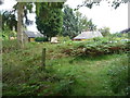
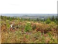
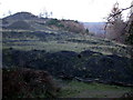
27 photos from this area
Area Information
Key information about the GL14 3AW including its size, population, and administrative classification.
- Area Type
- Postcode
- Area Size
- 3.6 km²
- Population
- 2039
- Population Density
- 110 people/km²
House Prices in GL14 3AW
40
Properties
£182,286
Average Sold Price
£38,000
Lowest Price
£458,000
Highest Price
Showing 40 properties
| Address | Type | Beds | Baths | Last Sale Price | Last Sale Date | |
|---|---|---|---|---|---|---|
| 79-81 Ruspidge Road, Ruspidge, GL14 3AW | Detached | 4 | 2 | £458,000 | Oct 2023 | |
| Rising Sun Cottage, 75 Ruspidge Road, Ruspidge, GL14 3AW | Semi-detached | 3 | 1 | £137,000 | Sep 2019 | |
| 1, Walmers View, Ruspidge Road, Ruspidge, GL14 3AW | house | - | - | £135,000 | Apr 2018 | |
| 67 Ruspidge Road, Ruspidge, GL14 3AW | Cottage | 3 | 1 | £255,000 | Jun 2016 | |
| 95 Ruspidge Road, Ruspidge, GL14 3AW | house | - | - | £140,000 | Mar 2010 | |
| 5, Walmers View, Ruspidge Road, Ruspidge, GL14 3AW | Detached | - | - | £113,000 | May 2007 | |
| 93 Ruspidge Road, Ruspidge, GL14 3AW | house | 2 | - | £38,000 | May 2001 | |
| Top Flat, Eastern United Works, Ruspidge Road, Ruspidge, GL14 3AW | Land | - | - | - | - | |
| Staple Edge Halt, 89 Ruspidge Road, Ruspidge, GL14 3AW | Land | - | - | - | - | |
| 61A Ruspidge Road, Ruspidge, GL14 3AW | Cottage | 4 | 3 | - | - |
Page 1 of 4
Energy Efficiency in GL14 3AW
Amenities
Schools
| Rank | School | Type | Entry gender | Ages |
|---|
Explore more schools in this area
Go to Schools tabDemographics
Household Size
Two person
most common
Accommodation Type
Houses
most common
Tenure
83
majority
Ethnic Group
White
most common
Religion
N/A
most common
Household Composition
N/A
most common
Age
47
median
Adults (30-64 years)
most common
Household Deprivation
N/A
with no deprivation
NS-SEC
32
in Lower managerial occupations
Explore more demographic insights in this area
Go to Demographics tabPlanning
Planning Constraints
- Flood RiskPremium
- Ramsar Wetland SitesPremium
- Area of Outstanding Natural BeautyPremium
- Protected Nature ReservePremium
- Protected WoodlandPremium