Area Overview for GL14 2TZ
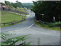
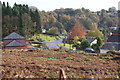
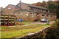
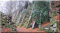
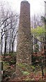
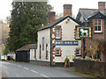
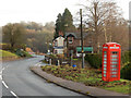
Photos of GL14 2TZ


Area Information
Living in GL14 2TZ means being part of a small, tightly knit residential cluster in England. The area covers 17 hectares and is home to 2039 people, giving it a population density of 110 people per square kilometre. This is a place where community ties are likely strong, with a population skewed towards adults aged 30–64. The area’s compact size means amenities and services are within easy reach, while its modest scale suggests a quieter, more personal living experience. With 83% of homes owned by residents, GL14 2TZ is predominantly a place of long-term occupancy, where families and individuals have established roots. The landscape is likely a mix of housing and green spaces, though specific details about local geography are not provided. For those seeking a balance between convenience and tranquillity, this postcode offers a snapshot of rural England, where the pace of life is slower and the sense of place is defined by proximity to nature and local traditions.
- Area Type
- Postcode
- Area Size
- 17.0 hectares
- Population
- 2039
- Population Density
- 110 people/km²
The property market in GL14 2TZ is dominated by owner-occupied homes, with 83% of residents living in properties they own. This high rate of home ownership suggests a stable and long-term residential population, with little reliance on the rental market. The accommodation type is exclusively houses, which is unusual for areas with higher population densities but aligns with the rural character of the postcode. Given the small area size of 17 hectares and the modest population, the housing stock is likely limited in both quantity and variety. This makes GL14 2TZ a niche market, where properties are likely to be in demand among those seeking a quiet, low-density living environment. Buyers should consider the area’s size and the predominance of houses when evaluating potential properties, as opportunities for new development may be constrained by the existing layout and planning constraints.
House Prices in GL14 2TZ
Showing 48 properties
| Address | Type | Beds | Baths | Last Sale Price | Last Sale Date | |
|---|---|---|---|---|---|---|
| Rock House, Lower Road, Soudley, GL14 2TZ | Semi-detached | 3 | 2 | £625,000 | Jul 2023 | |
| Sunningdale, Lower Road, Soudley, GL14 2TZ | Bungalow | - | - | £400,000 | Dec 2021 | |
| Crammond, Lower Road, Soudley, GL14 2TZ | Bungalow | 2 | 1 | £238,000 | Sep 2021 | |
| The Seasons, Lower Road, Soudley, GL14 2TZ | Detached | 5 | 2 | £315,000 | Mar 2021 | |
| The Old Forge, Lower Road, Soudley, GL14 2TZ | house | - | - | £390,000 | Nov 2020 | |
| Bankside, Lower Road, Soudley, GL14 2TZ | Bungalow | 2 | 1 | £180,000 | Jan 2019 | |
| Fairview, Lower Road, Soudley, GL14 2TZ | Cottage | 3 | 1 | £335,000 | Oct 2016 | |
| The Trap, Lower Road, Soudley, GL14 2TZ | Detached | 2 | 1 | £210,000 | Sep 2015 | |
| Rivendell, Lower Road, Soudley, GL14 2TZ | Bungalow | 3 | - | £215,000 | Mar 2015 | |
| Dean Vale, 4 Lower Road, Soudley, GL14 2TZ | Bungalow | 2 | 1 | £138,000 | Jul 2014 |
Energy Efficiency in GL14 2TZ
Daily life in GL14 2TZ is shaped by its proximity to a range of practical amenities. The area is within reach of five retail outlets, including Tesco Cinderford, Lidl Cinderford, and Co-op Valley, offering everyday shopping needs. For transport, the Dean Forest Railway and Lydney Railway Station provide connections to nearby towns, while ferries at Sharpness Old Docks and Lydney Harbour may offer leisure opportunities or alternative travel routes. The presence of the Dean Forest Railway also suggests access to scenic or historical sites, which could appeal to those interested in local culture or outdoor activities. These amenities contribute to a lifestyle that balances practicality with the potential for regional exploration, though the area’s small size means residents may need to travel further for more specialised services or entertainment.
Amenities
Schools
The nearest school to GL14 2TZ is Littledean Church of England Primary School, which serves the local community with a primary education offering. The school has an Ofsted rating of satisfactory, indicating it meets acceptable standards but may have areas for improvement. As a primary school, it caters to children aged 4–11, though no secondary schools are listed in the data. Families relying on this school will need to consider additional options for secondary education, potentially requiring travel to nearby towns. The presence of a single primary school suggests a focus on early education within the area, but the absence of higher-level schools highlights a potential limitation for families requiring a full range of educational facilities.
| Rank | School | Type | Entry gender | Ages |
|---|
Explore more schools in this area
Go to Schools tabDemographics
The community in GL14 2TZ is predominantly composed of adults aged 30–64, with a median age of 47. This suggests a mature population, likely with established careers and families. Home ownership is high, with 83% of residents living in properties they own, indicating a stable housing market and long-term residency. The area is characterised by houses rather than flats or apartments, reflecting a traditional, family-oriented housing stock. The predominant ethnic group is White, though no specific data on diversity or deprivation is available. The population density of 110 people per square kilometre implies a low-rise, spread-out settlement rather than a densely packed urban area. For those considering life here, the age profile suggests a community with a focus on stability and continuity, where local amenities and services cater to the needs of middle-aged residents and their families.
Household Size
Accommodation Type
Tenure
Ethnic Group
Religion
Household Composition
Age
Household Deprivation
NS-SEC
Explore more demographic insights in this area
Go to Demographics tabPlanning
Planning Constraints
- Flood RiskPremium
- Ramsar Wetland SitesPremium
- Area of Outstanding Natural BeautyPremium
- Protected Nature ReservePremium
- Protected WoodlandPremium