Area Overview for EX8 3DH
Photos of EX8 3DH
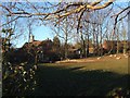
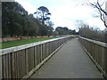
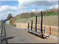
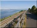
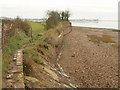
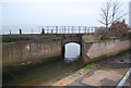
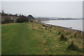
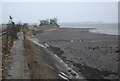
65 photos from this area
Area Information
Key information about the EX8 3DH including its size, population, and administrative classification.
- Area Type
- Postcode
- Area Size
- 13.7 hectares
- Population
- 1715
- Population Density
- 3812 people/km²
House Prices in EX8 3DH
61
Properties
£377,608
Average Sold Price
£95,000
Lowest Price
£770,000
Highest Price
Showing 61 properties
| Address | Type | Beds | Baths | Last Sale Price | Last Sale Date | |
|---|---|---|---|---|---|---|
| 84 Halsdon Avenue, Exmouth, EX8 3DH | Chalet | 3 | 4 | £685,000 | Dec 2022 | |
| 76 Halsdon Avenue, Exmouth, EX8 3DH | Detached | 3 | 2 | £770,000 | Mar 2022 | |
| 69 Halsdon Avenue, Exmouth, EX8 3DH | Bungalow | 3 | 2 | £440,000 | Jan 2021 | |
| 94 Halsdon Avenue, Exmouth, EX8 3DH | house | - | - | £430,000 | Jan 2017 | |
| 71 Halsdon Avenue, Exmouth, EX8 3DH | Bungalow | 3 | - | £440,000 | Oct 2016 | |
| 73 Halsdon Avenue, Exmouth, EX8 3DH | Bungalow | - | - | £415,000 | Aug 2016 | |
| 78 Halsdon Avenue, Exmouth, EX8 3DH | Chalet | 3 | - | £410,000 | Jan 2015 | |
| 82 Halsdon Avenue, Exmouth, EX8 3DH | Detached | 3 | - | £339,650 | Jan 2014 | |
| 63 Halsdon Avenue, Exmouth, EX8 3DH | Bungalow | 2 | 1 | £325,000 | Sep 2013 | |
| 59 Halsdon Avenue, Exmouth, EX8 3DH | Bungalow | 3 | - | £365,000 | Sep 2013 |
Page 1 of 7
Energy Efficiency in EX8 3DH
Amenities
Schools
| Rank | School | Type | Entry gender | Ages |
|---|
Explore more schools in this area
Go to Schools tabDemographics
Household Size
One person
most common
Accommodation Type
Flats
most common
Tenure
53
majority
Ethnic Group
White
most common
Religion
N/A
most common
Household Composition
N/A
most common
Age
47
median
Adults (30-64 years)
most common
Household Deprivation
N/A
with no deprivation
NS-SEC
36
in Lower managerial occupations
Explore more demographic insights in this area
Go to Demographics tabPlanning
Planning Constraints
- Flood RiskPremium
- Ramsar Wetland SitesPremium
- Area of Outstanding Natural BeautyPremium
- Protected Nature ReservePremium
- Protected WoodlandPremium