Area Overview for EX39 1BQ
Photos of EX39 1BQ


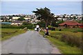


62 photos from this area
Area Information
Key information about the EX39 1BQ including its size, population, and administrative classification.
- Area Type
- Postcode
- Area Size
- 9659 m²
- Population
- 1801
- Population Density
- 1292 people/km²
House Prices in EX39 1BQ
26
Properties
£155,821
Average Sold Price
£90,000
Lowest Price
£260,000
Highest Price
Showing 26 properties
| Address | Type | Beds | Baths | Last Sale Price | Last Sale Date | |
|---|---|---|---|---|---|---|
| 25, Dolphin Court, Lundy View, Northam, EX39 1BQ | Flat | - | - | £260,000 | Oct 2024 | |
| 9, Dolphin Court, Lundy View, Northam, EX39 1BQ | Maisonette | 2 | 1 | £196,250 | Dec 2023 | |
| 10, Dolphin Court, Lundy View, Northam, EX39 1BQ | Flat | - | - | £207,500 | Aug 2023 | |
| 1, Dolphin Court, Lundy View, Northam, EX39 1BQ | Flat | - | - | £155,000 | Oct 2022 | |
| 17, Dolphin Court, Lundy View, Northam, EX39 1BQ | Flat | 2 | 1 | £185,000 | Aug 2022 | |
| 19, Dolphin Court, Lundy View, Northam, EX39 1BQ | Flat | - | - | £170,000 | Jan 2022 | |
| 20, Dolphin Court, Lundy View, Northam, EX39 1BQ | Maisonette | 2 | 1 | £173,000 | Nov 2021 | |
| 16, Dolphin Court, Lundy View, Northam, EX39 1BQ | Flat | - | - | £155,000 | Jul 2021 | |
| 7, Dolphin Court, Lundy View, Northam, EX39 1BQ | Flat | - | - | £169,000 | May 2021 | |
| 18, Dolphin Court, Lundy View, Northam, EX39 1BQ | Maisonette | - | - | £172,000 | Jan 2021 |
Page 1 of 3
Energy Efficiency in EX39 1BQ
Amenities
Schools
| Rank | School | Type | Entry gender | Ages |
|---|
Explore more schools in this area
Go to Schools tabDemographics
Household Size
Two person
most common
Accommodation Type
Houses
most common
Tenure
78
majority
Ethnic Group
White
most common
Religion
N/A
most common
Household Composition
N/A
most common
Age
47
median
Adults (30-64 years)
most common
Household Deprivation
N/A
with no deprivation
NS-SEC
30
in Lower managerial occupations
Explore more demographic insights in this area
Go to Demographics tabPlanning
Planning Constraints
- Flood RiskPremium
- Ramsar Wetland SitesPremium
- Area of Outstanding Natural BeautyPremium
- Protected Nature ReservePremium
- Protected WoodlandPremium