Area Overview for EX38 8QD
Photos of EX38 8QD
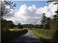
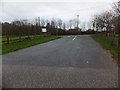

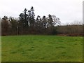
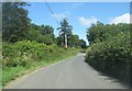
7 photos from this area
Area Information
Key information about the EX38 8QD including its size, population, and administrative classification.
- Area Type
- Postcode
- Area Size
- 1.0 km²
- Population
- 1513
- Population Density
- 21 people/km²
House Prices in EX38 8QD
6
Properties
£301,000
Average Sold Price
£120,000
Lowest Price
£482,000
Highest Price
Showing 6 properties
| Address | Type | Beds | Baths | Last Sale Price | Last Sale Date | |
|---|---|---|---|---|---|---|
| Lower Lodge, Road From Old Post Office To Little Marland Farm, Peters Marland, EX38 8QD | house | 4 | - | £482,000 | Nov 2016 | |
| Winscott Lodge, Road From Old Post Office To Little Marland Farm, Peters Marland, EX38 8QD | Detached | - | - | £120,000 | Nov 2000 | |
| HIGHER WINSCOTT, ROAD FROM WINSCOTT LODGE TO PRETTY TOP, Peters Marland, EX38 8QD | Detached | - | - | - | - | |
| Hamblys, Road From Winscott Lodge To Pretty Top, Peters Marland, EX38 8QD | Industrial | - | - | - | - | |
| Winscott Barton, Road From Winscott Lodge To Pretty Top, Peters Marland, EX38 8QD | Detached | - | - | - | - | |
| Winscott Lawn, Road From Old Post Office To Little Marland Farm, Peters Marland, EX38 8QD | Detached | - | - | - | - |
Energy Efficiency in EX38 8QD
Amenities
Schools
| Rank | School | Type | Entry gender | Ages |
|---|
Explore more schools in this area
Go to Schools tabDemographics
Household Size
Two person
most common
Accommodation Type
Houses
most common
Tenure
76
majority
Ethnic Group
White
most common
Religion
N/A
most common
Household Composition
N/A
most common
Age
47
median
Adults (30-64 years)
most common
Household Deprivation
N/A
with no deprivation
NS-SEC
29
in Lower managerial occupations
Explore more demographic insights in this area
Go to Demographics tabPlanning
Planning Constraints
- Ramsar Wetland SitesPremium
- Area of Outstanding Natural BeautyPremium
- Protected Nature ReservePremium
- Protected WoodlandPremium