Area Overview for EX33 2LA
Photos of EX33 2LA
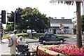
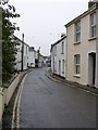
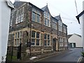
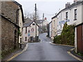
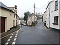
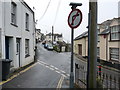
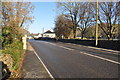
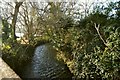
100 photos from this area
Area Information
Key information about the EX33 2LA including its size, population, and administrative classification.
- Area Type
- Postcode
- Area Size
- 2.6 hectares
- Population
- 2210
- Population Density
- 3704 people/km²
House Prices in EX33 2LA
45
Properties
£419,203
Average Sold Price
£242,500
Lowest Price
£575,000
Highest Price
Showing 45 properties
| Address | Type | Beds | Baths | Last Sale Price | Last Sale Date | |
|---|---|---|---|---|---|---|
| Sunny Nook, Hills View, Braunton, EX33 2LA | Semi-detached | 2 | 2 | £242,500 | Dec 2019 | |
| Channel View, Hills View, Braunton, EX33 2LA | Detached | 4 | 3 | £575,000 | Oct 2019 | |
| Eastholme, Hills View, Braunton, EX33 2LA | Detached | - | - | £360,000 | Feb 2016 | |
| Southcroft, Hills View, Braunton, EX33 2LA | Detached | 5 | 3 | £539,720 | Jun 2015 | |
| SPRINGHAVEN, HILLS VIEW, Braunton, EX33 2LA | Detached | - | - | £530,000 | Aug 2013 | |
| High Walls, Hills View, Braunton, EX33 2LA | Detached | - | - | £268,000 | Mar 2007 | |
| The Lodge, Hills View, Braunton, EX33 2LA | Bungalow | 2 | 1 | - | - | |
| 20A Hills View, Braunton, EX33 2LA | Flat | 1 | 1 | - | - | |
| 20 Hills View, Braunton, EX33 2LA | Detached | 3 | 2 | - | - | |
| Corner Cottage, Hills View, Braunton, EX33 2LA | Semi-detached | 2 | 1 | - | - |
Page 1 of 5
Energy Efficiency in EX33 2LA
Amenities
Schools
| Rank | School | Type | Entry gender | Ages |
|---|
Explore more schools in this area
Go to Schools tabDemographics
Household Size
Two person
most common
Accommodation Type
Houses
most common
Tenure
75
majority
Ethnic Group
White
most common
Religion
N/A
most common
Household Composition
N/A
most common
Age
47
median
Adults (30-64 years)
most common
Household Deprivation
N/A
with no deprivation
NS-SEC
32
in Lower managerial occupations
Explore more demographic insights in this area
Go to Demographics tabPlanning
Planning Constraints
- Flood RiskPremium
- Ramsar Wetland SitesPremium
- Area of Outstanding Natural BeautyPremium
- Protected Nature ReservePremium
- Protected WoodlandPremium