Area Overview for EX3 0PQ
Photos of EX3 0PQ
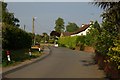
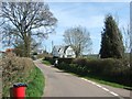
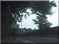
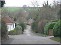
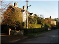
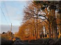
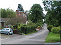
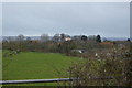
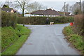
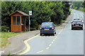
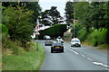
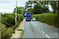
31 photos from this area
Area Information
Key information about the EX3 0PQ including its size, population, and administrative classification.
- Area Type
- Postcode
- Area Size
- 29.1 hectares
- Population
- 1775
- Population Density
- 93 people/km²
House Prices in EX3 0PQ
19
Properties
£575,091
Average Sold Price
£116,000
Lowest Price
£1,150,000
Highest Price
Showing 19 properties
| Address | Type | Beds | Baths | Last Sale Price | Last Sale Date | |
|---|---|---|---|---|---|---|
| Rosemount, Exmouth Road, Exton, EX3 0PQ | Bungalow | 3 | 2 | £568,000 | Aug 2024 | |
| 2, Wood Cottages, Exmouth Road, Exton, EX3 0PQ | Terraced | 3 | 1 | £310,000 | Oct 2023 | |
| Holywell, Exmouth Road, Exton, EX3 0PQ | Detached | 4 | 2 | £975,000 | Dec 2022 | |
| The Old School, Exmouth Road, Exton, EX3 0PQ | house | 4 | - | £895,000 | Nov 2022 | |
| Coppins, Exmouth Road, Exton, EX3 0PQ | house | - | - | £1,150,000 | May 2022 | |
| Raglans, Exmouth Road, Exton, EX3 0PQ | Detached | 4 | 2 | £417,000 | Jul 2015 | |
| Morven, Exmouth Road, Exton, EX3 0PQ | Bungalow | - | - | £485,000 | Jul 2013 | |
| Hillside, Exmouth Road, Exton, EX3 0PQ | house | - | - | £750,000 | Apr 2009 | |
| Pinehurst, Exmouth Road, Exton, EX3 0PQ | Detached | - | - | £475,000 | Jun 2008 | |
| Chatfield, Exmouth Road, Exton, EX3 0PQ | Detached | - | - | £185,000 | May 1998 |
Page 1 of 2
Energy Efficiency in EX3 0PQ
Amenities
Schools
| Rank | School | Type | Entry gender | Ages |
|---|
Explore more schools in this area
Go to Schools tabDemographics
Household Size
Two person
most common
Accommodation Type
Houses
most common
Tenure
84
majority
Ethnic Group
White
most common
Religion
N/A
most common
Household Composition
N/A
most common
Age
22
median
Young Adults (15-29 years)
most common
Household Deprivation
N/A
with no deprivation
NS-SEC
41
in Lower managerial occupations
Explore more demographic insights in this area
Go to Demographics tabPlanning
Planning Constraints
- Flood RiskPremium
- Ramsar Wetland SitesPremium
- Area of Outstanding Natural BeautyPremium
- Protected Nature ReservePremium
- Protected WoodlandPremium