Area Overview for EX3 0PN
Photos of EX3 0PN

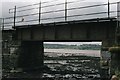
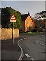

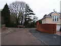
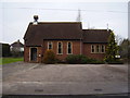
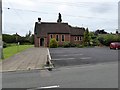


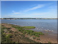

101 photos from this area
Area Information
Key information about the EX3 0PN including its size, population, and administrative classification.
- Area Type
- Postcode
- Area Size
- 6.3 hectares
- Population
- 1775
- Population Density
- 93 people/km²
House Prices in EX3 0PN
29
Properties
£598,593
Average Sold Price
£60,000
Lowest Price
£950,000
Highest Price
Showing 29 properties
| Address | Type | Beds | Baths | Last Sale Price | Last Sale Date | |
|---|---|---|---|---|---|---|
| Moonstone, Lane To The Briary, Exton Lane, Exton, EX3 0PN | Semi-detached | 4 | 2 | £900,000 | Jul 2024 | |
| The Holt, Lane To The Briary, Exton Lane, Exton, EX3 0PN | Semi-detached | 4 | 2 | £825,000 | Aug 2019 | |
| Firleigh Court, Lane To The Briary, Exton Lane, Exton, EX3 0PN | Detached | 5 | 4 | £750,000 | Nov 2018 | |
| Ailleagan, Lane To The Briary, Exton Lane, Exton, EX3 0PN | Detached | 4 | - | £580,000 | Nov 2017 | |
| Brentwood, Lane To The Briary, Exton Lane, Exton, EX3 0PN | house | - | - | £720,000 | Aug 2017 | |
| Amble Side, Lane To The Briary, Exton Lane, Exton, EX3 0PN | Bungalow | - | - | £610,500 | Feb 2017 | |
| Maples, Lane To The Briary, Exton Lane, Exton, EX3 0PN | house | - | - | £675,000 | Jan 2017 | |
| Newcote, Lane To The Briary, Exton Lane, Exton, EX3 0PN | house | - | - | £780,000 | Apr 2013 | |
| Willows, Lane To The Briary, Exton Lane, Exton, EX3 0PN | Detached | 6 | - | £650,000 | May 2012 | |
| Pelham House, Road To Samling, Exton Lane, Exton, EX3 0PN | house | - | - | £835,000 | Oct 2011 |
Page 1 of 3
Energy Efficiency in EX3 0PN
Amenities
Schools
| Rank | School | Type | Entry gender | Ages |
|---|
Explore more schools in this area
Go to Schools tabDemographics
Household Size
Two person
most common
Accommodation Type
Houses
most common
Tenure
84
majority
Ethnic Group
White
most common
Religion
N/A
most common
Household Composition
N/A
most common
Age
22
median
Young Adults (15-29 years)
most common
Household Deprivation
N/A
with no deprivation
NS-SEC
41
in Lower managerial occupations
Explore more demographic insights in this area
Go to Demographics tabPlanning
Planning Constraints
- Flood RiskPremium
- Ramsar Wetland SitesPremium
- Area of Outstanding Natural BeautyPremium
- Protected Nature ReservePremium
- Protected WoodlandPremium