Area Overview for EX2 8GR
Photos of EX2 8GR


Area Information
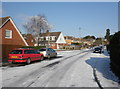
Living in EX2 8GR means inhabiting a tightly packed residential cluster in England, where 1,541 people reside across 7,290 square metres. The area’s compact size and high population density—211,385 people per square kilometre—create a densely populated environment, typical of small urban pockets. This postcode is defined by its proximity to transport hubs, including five railway stations within practical reach, such as Exeter St Thomas and Exeter Central. Daily life here is shaped by its connectivity to Exeter International Airport and three ferry landings, including Topsham Lock Ferry Landing. The area’s character is influenced by its demographics: residents skew older, with a median age of 47, and most are adults aged 30–64. While the housing stock is predominantly flats, the community’s compact nature means amenities are within walking distance, from local shops like Spar Quayside to retail outlets such as Iceland Alphington. However, the area’s small size also means limited space for greenery or expansive public areas, a trade-off for its convenience and accessibility.
- Area Type
- Postcode
- Area Size
- 7290 m²
- Population
- 1541
- Population Density
- 2569 people/km²
The property market in EX2 8GR is characterised by a high concentration of flats, with no data indicating the presence of detached or semi-detached homes. At 42% home ownership, the area leans more towards rental properties than owner-occupied homes, which may reflect the nature of its housing stock or local economic factors. For buyers, this means limited availability of owner-occupied properties, with flats being the primary option. The small area size and high density suggest that property choices are constrained, and competition for available units may be fierce. Prospective buyers should consider the implications of living in a flat—potentially higher rental costs, shared walls, and limited outdoor space. The proximity to transport links, however, could offset these drawbacks for commuters or those prioritising convenience over private living space.
House Prices in EX2 8GR
Showing 2 properties
| Address | Type | Beds | Baths | Last Sale Price | Last Sale Date | |
|---|---|---|---|---|---|---|
| Watersport, Unit 2, Maclaines Warehouse, Haven Road, Exeter, EX2 8GR | Industrial | - | - | - | - | |
| Haven Banks Outdoor Education Centre, Haven Road, Exeter, EX2 8GR | commercial | - | - | - | - |
Energy Efficiency in EX2 8GR
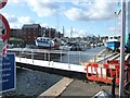
Residents of EX2 8GR have access to a range of amenities within walking or short driving distance. Local shops include Spar Quayside, Co-op Haven, and Iceland Alphington, providing essentials and convenience for daily life. The area’s proximity to rail networks, including Exeter St Thomas and Exeter Central stations, ensures easy access to regional transport. Ferry landings such as Topsham Lock Ferry Landing add to the connectivity, offering water-based travel options. The presence of Exeter International Airport nearby further enhances mobility. While the area lacks large parks or leisure facilities, the compact layout means amenities are tightly clustered, reducing the need for long commutes. This density supports a lifestyle where errands, work, and social activities are all within reach, though the limited green space may appeal more to those prioritising convenience over expansive outdoor areas.
Amenities
Schools
| Rank | School | Type | Entry gender | Ages |
|---|
Explore more schools in this area
Go to Schools tabDemographics
The community in EX2 8GR is predominantly middle-aged, with a median age of 47 and 62% of residents falling within the 30–64 age range. Home ownership is relatively low at 42%, suggesting a higher proportion of renters, which may reflect the area’s compact, possibly older housing stock. The accommodation type is almost exclusively flats, which aligns with the high population density. The predominant ethnic group is White, though specific data on diversity is not provided. The age profile indicates a settled population, likely with established careers and families, though the lack of younger residents may affect local schools and community dynamics. The absence of detailed deprivation data means the area’s economic resilience or challenges cannot be fully assessed, but the demographic mix suggests a stable, if aging, community.
Household Size
Accommodation Type
Tenure
Ethnic Group
Religion
Household Composition
Age
Household Deprivation
NS-SEC
Explore more demographic insights in this area
Go to Demographics tabPlanning
Planning Constraints
- Flood RiskPremium
- Ramsar Wetland SitesPremium
- Area of Outstanding Natural BeautyPremium
- Protected Nature ReservePremium
- Protected WoodlandPremium