Area Overview for EX2 4AR
Photos of EX2 4AR


Area Information
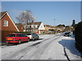
Living in EX2 4AR means being part of a tightly knit residential cluster in England, home to 1,541 people. This small postcode area is defined by its proximity to transport hubs and local amenities, making it practical for daily life. The community here is predominantly adults aged 30–64, with a median age of 47, suggesting a mature, stable population. While the area lacks natural constraints like protected woodlands or wetlands, it benefits from low flood risk, ensuring safety from environmental hazards. Residents enjoy access to multiple railway stations, including Exeter St Thomas and Exeter Central, as well as ferry landings along the river. The presence of Exeter International Airport within reach adds to the area’s connectivity. Daily life here balances convenience with a quieter, residential character, ideal for those seeking proximity to transport without urban sprawl.
- Area Type
- Postcode
- Area Size
- Not available
- Population
- 1541
- Population Density
- 2569 people/km²
The property market in EX2 4AR is characterised by a high proportion of flats, with no data suggesting the presence of larger homes or detached properties. Home ownership stands at 42%, which is notably lower than in many similar areas, pointing to a rental market that may dominate. This dynamic could mean limited options for buyers seeking owner-occupied properties, though the small size of the area may concentrate housing stock in specific developments. The prevalence of flats suggests a focus on efficiency and proximity to transport, which aligns with the area’s accessibility to railway stations and ferry routes. For buyers, this means competition for available properties and a need to consider rental alternatives. The compact nature of EX2 4AR also means that nearby areas may offer more variety, though proximity to Exeter’s infrastructure is a key selling point.
House Prices in EX2 4AR
No properties found in this postcode.
Energy Efficiency in EX2 4AR
Daily life in EX2 4AR is shaped by its proximity to retail, transport, and leisure options. The area has five retail outlets within reach, including Spar Quayside, Co-op Haven, and Iceland Alphington, offering essential shopping and convenience. Residents can access five railway stations, three ferry landings, and Exeter International Airport, ensuring seamless travel for work or leisure. While the area itself is small, its integration with Exeter’s infrastructure means residents can easily access larger urban amenities. The presence of multiple transport options and nearby retail hubs creates a lifestyle that balances convenience with a quieter residential environment. This makes EX2 4AR ideal for those who value accessibility without the chaos of a dense city.
Amenities
Schools
| Rank | School | Type | Entry gender | Ages |
|---|
Explore more schools in this area
Go to Schools tabDemographics
The population of EX2 4AR is largely composed of adults aged 30–64, with a median age of 47. This suggests a community of established professionals and families, rather than a younger or elderly demographic. Home ownership rates stand at 42%, indicating that nearly half of residents rent their homes, which may reflect a mix of rental properties and owner-occupied flats. The accommodation type is predominantly flats, which aligns with the area’s compact nature and limited space for larger housing. The predominant ethnic group is White, with no specific data on diversity beyond this. While 42% ownership is lower than the national average, it does not necessarily indicate deprivation, but rather a reliance on rental markets or shared ownership models. This profile suggests a community focused on practical living over luxury.
Household Size
Accommodation Type
Tenure
Ethnic Group
Religion
Household Composition
Age
Household Deprivation
NS-SEC
Explore more demographic insights in this area
Go to Demographics tabPlanning
Planning Constraints
- Flood RiskPremium
- Ramsar Wetland SitesPremium
- Area of Outstanding Natural BeautyPremium
- Protected Nature ReservePremium
- Protected WoodlandPremium