Area Overview for EX2 8EW
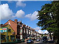
Photos of EX2 8EW


Area Information
Living in EX2 8EW means inhabiting a tightly packed residential cluster in England, where 1,541 people reside across just 6,773 square metres. This results in a population density of 227,536 people per square kilometre, reflecting a compact, possibly densely developed area. The community is characterised by a mature demographic, with a median age of 47 and most residents falling within the 30-64 age range. Daily life here is shaped by proximity to transport hubs, including five nearby railway stations such as Exeter St Thomas and Exeter Central, and practical access to ferry services like Topsham Lock Ferry Landing. The area’s small size means residents are likely to know their neighbours, though the high population density may influence the pace of life. With a broadband score of 94, internet connectivity is robust, supporting remote work and digital lifestyles. However, the area’s critical flood risk and above-average crime rates are factors to consider for those prioritising safety and long-term stability.
- Area Type
- Postcode
- Area Size
- 6773 m²
- Population
- 1541
- Population Density
- 2569 people/km²
The property market in EX2 8EW is defined by a 42% home ownership rate, indicating that more than half of residents rent their homes. The accommodation type is predominantly flats, which may reflect the area’s compact size and the need for efficient land use. This suggests a rental-oriented market, possibly catering to commuters or those seeking affordable housing in proximity to transport links. The small area size means the housing stock is limited, with little scope for expansion or new developments. Buyers should consider the high population density and the predominance of flats when evaluating property options. The area’s proximity to Exeter’s railway stations and the Exeter International Airport may appeal to those prioritising connectivity, though the critical flood risk and crime concerns could impact property desirability.
House Prices in EX2 8EW
Showing 42 properties
| Address | Type | Beds | Baths | Last Sale Price | Last Sale Date | |
|---|---|---|---|---|---|---|
| 4 Chamberlain Road, Exeter, EX2 8EW | house | 3 | 1 | £270,000 | May 2025 | |
| 34 Chamberlain Road, Exeter, EX2 8EW | Terraced | 2 | 1 | £240,000 | Jul 2024 | |
| 36 Chamberlain Road, Exeter, EX2 8EW | Terraced | 3 | 1 | £247,000 | Apr 2022 | |
| 11 Chamberlain Road, Exeter, EX2 8EW | house | 2 | - | £235,000 | Sep 2021 | |
| 12 Chamberlain Road, Exeter, EX2 8EW | Terraced | 2 | 1 | £182,000 | Aug 2021 | |
| 14 Chamberlain Road, Exeter, EX2 8EW | house | - | - | £234,000 | May 2021 | |
| 24 Chamberlain Road, Exeter, EX2 8EW | house | 3 | 1 | £184,000 | Dec 2020 | |
| 25 Chamberlain Road, Exeter, EX2 8EW | Semi-detached | 2 | - | £229,950 | Oct 2020 | |
| 17 Chamberlain Road, Exeter, EX2 8EW | house | - | - | £215,000 | Oct 2020 | |
| 29 Chamberlain Road, Exeter, EX2 8EW | Semi-detached | 3 | 1 | £217,500 | Dec 2019 |
Energy Efficiency in EX2 8EW
Residents of EX2 8EW have access to a range of amenities within practical reach, including five retail outlets such as Iceland Alphington, Aldi St, and Co-op Haven, which cater to everyday shopping needs. The area’s proximity to Exeter’s railway stations, including Exeter St Thomas and Exeter Central, ensures convenient commuting options. Ferry landings like Topsham Ferry Landing provide additional transport links, while the Exeter International Airport is a short distance away for air travel. Though the area’s small size limits large-scale leisure facilities, the presence of multiple retail and transport hubs suggests a functional, service-oriented lifestyle. The combination of shops, transport, and nearby natural waterways may appeal to those seeking a balance between convenience and connectivity, though the lack of detailed data on parks or recreational spaces means these aspects remain unexplored in the provided information.
Amenities
Schools
| Rank | School | Type | Entry gender | Ages |
|---|
Explore more schools in this area
Go to Schools tabDemographics
The population of EX2 8EW is predominantly adults aged 30-64, with a median age of 47, indicating a mature, established community. Home ownership here is relatively low at 42%, suggesting a higher proportion of renters compared to owner-occupiers. The accommodation type is largely flats, reflecting a housing stock suited to smaller households or those preferring low-maintenance living. The predominant ethnic group is White, though specific data on diversity or deprivation is not provided. The age profile and home ownership figures suggest a mix of professionals, retirees, and families, with limited data on income levels or socioeconomic status. The high population density, combined with the prevalence of flats, may influence the area’s social dynamics, fostering a sense of community but potentially limiting private outdoor space.
Household Size
Accommodation Type
Tenure
Ethnic Group
Religion
Household Composition
Age
Household Deprivation
NS-SEC
Explore more demographic insights in this area
Go to Demographics tabPlanning
Planning Constraints
- Flood RiskPremium
- Ramsar Wetland SitesPremium
- Area of Outstanding Natural BeautyPremium
- Protected Nature ReservePremium
- Protected WoodlandPremium