Area Overview for EX2 8ER
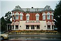
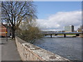
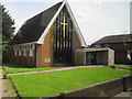
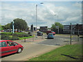
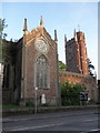
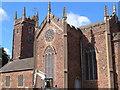
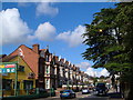
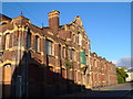
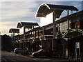
Photos of EX2 8ER


Area Information
Living in EX2 8ER means being part of a tightly knit residential cluster in England, where 1,541 people reside across 8,729 square metres. This small area, though densely populated at 176,531 people per square kilometre, offers a compact, accessible environment. Its proximity to Exeter’s transport hubs and amenities makes it practical for daily life. The area is defined by its flat-dominated housing stock, reflecting a community shaped by urban living. While the population density is exceptionally high, the presence of multiple rail stations, ferry landings, and nearby Exeter International Airport ensures connectivity to broader networks. Residents here are likely to be adults aged 30–64, drawn by the area’s convenience and proximity to services. However, the high flood risk and crime levels demand careful consideration. For those prioritising accessibility over space, EX2 8ER provides a functional, if challenging, base for urban living.
- Area Type
- Postcode
- Area Size
- 8729 m²
- Population
- 1541
- Population Density
- 2569 people/km²
The property market in EX2 8ER is characterised by a high proportion of rental properties, with only 42% owner-occupied homes. This suggests a transient population and limited availability of owner-occupied housing. The accommodation type is predominantly flats, which are more common in densely populated urban areas. Given the small area size of 8,729 square metres, the housing stock is constrained, and the immediate surroundings likely offer few alternatives. For buyers, this means competition for a limited number of properties, most of which are flats. The rental market may be more active, but buyers should consider the long-term viability of ownership in an area with high population density and potential environmental risks. The flat-dominated landscape also means limited scope for home modifications or expansions.
House Prices in EX2 8ER
Showing 59 properties
| Address | Type | Beds | Baths | Last Sale Price | Last Sale Date | |
|---|---|---|---|---|---|---|
| 27 Fords Road, Exeter, EX2 8ER | Terraced | 2 | 1 | £237,500 | Feb 2025 | |
| 22 Fords Road, Exeter, EX2 8ER | Terraced | 3 | - | £125,000 | Mar 2022 | |
| 39 Fords Road, Exeter, EX2 8ER | Terraced | 2 | 1 | £230,000 | Jun 2021 | |
| 26 Fords Road, Exeter, EX2 8ER | Terraced | 2 | 1 | £220,000 | Mar 2021 | |
| 19 Fords Road, Exeter, EX2 8ER | Terraced | 2 | 1 | £160,000 | Jul 2020 | |
| 24 Fords Road, Exeter, EX2 8ER | Terraced | 3 | 1 | £217,000 | Feb 2020 | |
| 6 Fords Road, Exeter, EX2 8ER | Terraced | 2 | - | £206,000 | Nov 2018 | |
| 34 Fords Road, Exeter, EX2 8ER | house | - | - | £195,000 | Aug 2017 | |
| 33 Fords Road, Exeter, EX2 8ER | Terraced | 2 | 1 | £176,000 | Oct 2016 | |
| 42 Fords Road, Exeter, EX2 8ER | Terraced | 3 | 1 | £172,000 | Sep 2016 |
Energy Efficiency in EX2 8ER
Residents of EX2 8ER have access to a range of nearby amenities within practical reach. Retail options include Iceland Alphington, Aldi St, and Co-op Haven, providing essential shopping for daily needs. The area’s rail network, with stations like Exeter St Thomas and Marsh Barton, connects to Exeter’s city centre and beyond, while ferry landings such as Topsham Lock and Turf Lock Inn offer scenic travel routes. Exeter International Airport is a short distance away, catering to those with travel needs. Though the area is small, these amenities create a functional lifestyle, blending urban convenience with access to transport. However, the lack of parks or leisure facilities within the immediate vicinity may require residents to travel further for recreational activities. The compact nature of the area ensures that essential services are close, but the limited space means a focus on efficiency over expansive leisure options.
Amenities
Schools
| Rank | School | Type | Entry gender | Ages |
|---|
Explore more schools in this area
Go to Schools tabDemographics
The community in EX2 8ER is predominantly composed of adults aged 30–64, with a median age of 47. This suggests a mature population, likely balancing work and retirement. Home ownership rates are relatively low at 42%, indicating a rental market dominance. The accommodation type is almost exclusively flats, reflecting a lack of larger homes or detached properties. The predominant ethnic group is White, with no specific data on other demographics provided. The high population density of 176,531 people per square kilometre implies a compact, possibly high-pressure living environment. While this density can foster community interaction, it may also contribute to challenges in privacy and space. The age profile suggests a stable, working-age population, but the lack of younger residents could impact local schools and amenities.
Household Size
Accommodation Type
Tenure
Ethnic Group
Religion
Household Composition
Age
Household Deprivation
NS-SEC
Explore more demographic insights in this area
Go to Demographics tabPlanning
Planning Constraints
- Flood RiskPremium
- Ramsar Wetland SitesPremium
- Area of Outstanding Natural BeautyPremium
- Protected Nature ReservePremium
- Protected WoodlandPremium