Area Overview for EX2 7QE
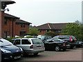
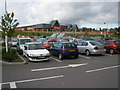
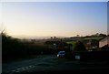
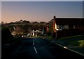
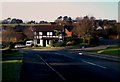
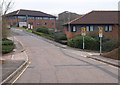
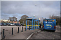
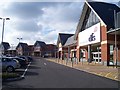
Photos of EX2 7QE

Area Information
Living in EX2 7QE means being part of a compact, residential cluster in England, where 1,704 people reside across 2.9 hectares. The area’s high population density of 59,404 people per square kilometre reflects a tightly knit community, ideal for those seeking proximity to amenities without sprawling urban sprawl. This postcode is defined by its small-scale character, with homes predominantly owned by residents rather than rented. The area’s demographic profile suggests a mature population, with a median age of 47 and a majority of adults aged 30–64. Daily life here is shaped by proximity to rail networks, retail hubs, and ferry services, making it practical for commuters and families. While the area lacks large-scale natural or protected designations, its accessibility to Exeter International Airport and multiple railway stations positions it as a strategic location for both local and regional connectivity.
- Area Type
- Postcode
- Area Size
- 2.9 hectares
- Population
- 1704
- Population Density
- 3858 people/km²
The property market in EX2 7QE is dominated by owner-occupied homes, with 85% of properties owned by residents rather than rented out. This high rate of home ownership suggests a community focused on long-term investment and stability. The area’s housing stock is primarily composed of houses, which is unusual for smaller postcode areas that often include more flats or terraced properties. This mix may appeal to buyers seeking traditional family homes with private gardens or space. Given the area’s compact size, property availability is likely limited, making it a niche market for those prioritising proximity to transport links and amenities. Buyers should consider the small footprint of the area when exploring nearby options, as expansion may be constrained by surrounding land use.
House Prices in EX2 7QE
Showing 53 properties
| Address | Type | Beds | Baths | Last Sale Price | Last Sale Date | |
|---|---|---|---|---|---|---|
| 14 Bathern Road, Exeter, EX2 7QE | Terraced | 3 | 2 | £310,000 | Nov 2024 | |
| 19 Bathern Road, Exeter, EX2 7QE | Terraced | 3 | 2 | £325,000 | Jun 2024 | |
| 23 Bathern Road, Exeter, EX2 7QE | Terraced | 3 | 2 | £305,000 | Oct 2023 | |
| 73 Bathern Road, Exeter, EX2 7QE | Flat | 2 | 1 | £240,000 | Nov 2022 | |
| 63 Bathern Road, Exeter, EX2 7QE | Terraced | 4 | 2 | £330,000 | Jun 2022 | |
| 11 Bathern Road, Exeter, EX2 7QE | Terraced | 1 | 1 | £185,000 | May 2022 | |
| 43 Bathern Road, Exeter, EX2 7QE | Flat | 2 | 1 | £226,000 | May 2022 | |
| 15 Bathern Road, Exeter, EX2 7QE | Retail | 3 | 2 | £295,525 | Apr 2022 | |
| 22 Bathern Road, Exeter, EX2 7QE | Terraced | 3 | 2 | £265,100 | Jul 2021 | |
| 51 Bathern Road, Exeter, EX2 7QE | Terraced | 4 | 1 | £318,000 | Jun 2021 |
Energy Efficiency in EX2 7QE
The lifestyle in EX2 7QE is shaped by its proximity to a variety of amenities. Retailers such as M&S Exeter M5 Moto SF, Tesco Exeter, and Morrisons Daily offer daily essentials, while multiple railway stations provide easy access to broader networks. Ferry landings at Topsham and Turf Lock Inn add a unique dimension, connecting residents to local waterways and nearby towns. The presence of Exeter International Airport enhances travel flexibility, supporting both business and leisure trips. These amenities contribute to a practical, convenience-driven lifestyle, where residents can manage shopping, commuting, and travel efficiently. The area’s compact nature ensures that essential services are within walking or short driving distance, fostering a sense of ease in daily routines.
Amenities
Schools
The nearest school to EX2 7QE is St Peter’s Church of England Aided School, a primary school with a Good Ofsted rating. This institution serves the local community, offering education for younger children in a setting that balances academic standards with religious affiliation. The presence of a primary school within reach is a key consideration for families, ensuring access to early education without long commutes. While no secondary schools are listed in the data, the proximity to Exeter’s broader network of schools suggests additional options may be available nearby. The single primary school in the area reflects a focus on foundational education, though families requiring secondary schooling may need to look beyond the immediate postcode.
| Rank | School | Type | Entry gender | Ages |
|---|
Explore more schools in this area
Go to Schools tabDemographics
The community in EX2 7QE is predominantly composed of adults aged 30–64, with a median age of 47. This suggests a stable, established population, likely with strong ties to local employment and services. Home ownership is high at 85%, indicating a preference for long-term residency over rental properties. The area is characterised by houses as the primary accommodation type, reflecting a more traditional housing stock compared to flats or apartments. The predominant ethnic group is White, which aligns with broader trends in the region. While no specific data on deprivation is provided, the high home ownership rate and age profile suggest a community with relatively stable economic conditions. However, the absence of detailed diversity metrics means broader demographic nuances remain unexplored.
Household Size
Accommodation Type
Tenure
Ethnic Group
Religion
Household Composition
Age
Household Deprivation
NS-SEC
Explore more demographic insights in this area
Go to Demographics tabPlanning
Planning Constraints
- Flood RiskPremium
- Ramsar Wetland SitesPremium
- Area of Outstanding Natural BeautyPremium
- Protected Nature ReservePremium
- Protected WoodlandPremium