Area Overview for EX2 7EE
Photos of EX2 7EE


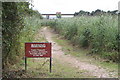

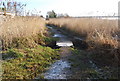
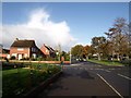
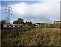


94 photos from this area
Area Information
Key information about the EX2 7EE including its size, population, and administrative classification.
- Area Type
- Postcode
- Area Size
- 4.3 hectares
- Population
- 1575
- Population Density
- 2232 people/km²
House Prices in EX2 7EE
52
Properties
£190,431
Average Sold Price
£25,480
Lowest Price
£325,000
Highest Price
Showing 52 properties
| Address | Type | Beds | Baths | Last Sale Price | Last Sale Date | |
|---|---|---|---|---|---|---|
| 68 Newport Road, Exeter, EX2 7EE | Semi-detached | 3 | 2 | £317,000 | Jan 2025 | |
| 31 Newport Road, Exeter, EX2 7EE | Semi-detached | 3 | 1 | £315,000 | Jul 2024 | |
| 33 Newport Road, Exeter, EX2 7EE | Terraced | 3 | 1 | £280,000 | Feb 2024 | |
| 54 Newport Road, Exeter, EX2 7EE | Semi-detached | 3 | 1 | £241,800 | Jun 2023 | |
| 56 Newport Road, Exeter, EX2 7EE | house | - | - | £325,000 | Nov 2022 | |
| 23 Newport Road, Exeter, EX2 7EE | house | - | - | £248,000 | May 2022 | |
| 46 Newport Road, Exeter, EX2 7EE | house | - | - | £250,000 | Aug 2021 | |
| 58 Newport Road, Exeter, EX2 7EE | Terraced | 4 | 1 | £258,000 | Sep 2018 | |
| 38 Newport Road, Exeter, EX2 7EE | Semi-detached | 3 | 1 | £245,000 | Oct 2017 | |
| 36 Newport Road, Exeter, EX2 7EE | house | - | - | £225,000 | Sep 2017 |
Page 1 of 6
Energy Efficiency in EX2 7EE
Amenities
Schools
| Rank | School | Type | Entry gender | Ages |
|---|
Explore more schools in this area
Go to Schools tabDemographics
Household Size
Family (3-5 people)
most common
Accommodation Type
Houses
most common
Tenure
56
majority
Ethnic Group
White
most common
Religion
N/A
most common
Household Composition
N/A
most common
Age
47
median
Adults (30-64 years)
most common
Household Deprivation
N/A
with no deprivation
NS-SEC
26
in Lower managerial occupations
Explore more demographic insights in this area
Go to Demographics tabPlanning
Planning Constraints
- Flood RiskPremium
- Area of Outstanding Natural BeautyPremium
- Protected Nature ReservePremium
- Protected WoodlandPremium