Area Overview for EX15 3TS
Photos of EX15 3TS
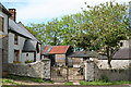
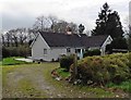
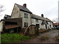
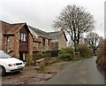
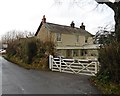
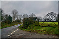
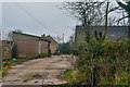
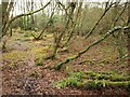
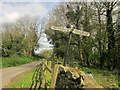
17 photos from this area
Area Information
Key information about the EX15 3TS including its size, population, and administrative classification.
- Area Type
- Postcode
- Area Size
- 22.6 hectares
- Population
- 2006
- Population Density
- 71 people/km²
House Prices in EX15 3TS
7
Properties
£292,500
Average Sold Price
£110,000
Lowest Price
£485,000
Highest Price
Showing 7 properties
| Address | Type | Beds | Baths | Last Sale Price | Last Sale Date | |
|---|---|---|---|---|---|---|
| Highfields Barn, Lane From Garlandhayes To Wiltown Cross, Clayhidon, EX15 3TS | house | - | - | £485,000 | Apr 2021 | |
| Heather, Lane From Garlandhayes To Wiltown Cross, Clayhidon, EX15 3TS | Bungalow | - | - | £245,000 | Feb 2020 | |
| Pleasant House, Lane From Garlandhayes To Wiltown Cross, Clayhidon, EX15 3TS | house | - | - | £330,000 | May 2003 | |
| Bluebank, Lane From Garlandhayes To Wiltown Cross, Clayhidon, EX15 3TS | Detached | - | - | £110,000 | May 2000 | |
| Oaklands, Lane From Garlandhayes To Wiltown Cross, Clayhidon, EX15 3TS | Retail | - | - | - | - | |
| Highfields, Lane From Garlandhayes To Wiltown Cross, Clayhidon, EX15 3TS | house | - | - | - | - | |
| Land And Buildings At Grid Reference 317235 116211, Lane From Garlandhayes To Wiltown Cross, Clayhidon, EX15 3TS | Leisure | - | - | - | - |
Energy Efficiency in EX15 3TS
Amenities
Schools
| Rank | School | Type | Entry gender | Ages |
|---|
Explore more schools in this area
Go to Schools tabDemographics
Household Size
Two person
most common
Accommodation Type
Houses
most common
Tenure
71
majority
Ethnic Group
White
most common
Religion
N/A
most common
Household Composition
N/A
most common
Age
47
median
Adults (30-64 years)
most common
Household Deprivation
N/A
with no deprivation
NS-SEC
36
in Lower managerial occupations
Explore more demographic insights in this area
Go to Demographics tabPlanning
Planning Constraints
- Flood RiskPremium
- Ramsar Wetland SitesPremium
- Area of Outstanding Natural BeautyPremium
- Protected Nature ReservePremium
- Protected WoodlandPremium