Area Overview for EX13 5SZ
Photos of EX13 5SZ
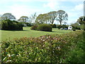

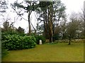

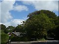
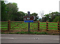


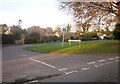


17 photos from this area
Area Information
Key information about the EX13 5SZ including its size, population, and administrative classification.
- Area Type
- Postcode
- Area Size
- 11.3 hectares
- Population
- 1736
- Population Density
- 74 people/km²
House Prices in EX13 5SZ
37
Properties
£423,714
Average Sold Price
£50,000
Lowest Price
£940,000
Highest Price
Showing 37 properties
| Address | Type | Beds | Baths | Last Sale Price | Last Sale Date | |
|---|---|---|---|---|---|---|
| Stoneygate, Charmouth Road, Axminster, EX13 5SZ | Detached | 5 | 2 | £700,000 | Mar 2025 | |
| Hilltop View, Charmouth Road, Axminster, EX13 5SZ | Detached | 3 | 2 | £337,050 | May 2024 | |
| The Chancellors, Charmouth Road, Axminster, EX13 5SZ | house | - | - | £940,000 | Nov 2021 | |
| Devoncrest, Charmouth Road, Axminster, EX13 5SZ | Detached | 5 | 2 | £550,000 | Nov 2019 | |
| Boschetto, Charmouth Road, Axminster, EX13 5SZ | Bungalow | 3 | 2 | £530,000 | May 2019 | |
| Windyridge, Charmouth Road, Axminster, EX13 5SZ | Bungalow | 2 | 2 | £337,500 | Aug 2017 | |
| Acorns, Charmouth Road, Axminster, EX13 5SZ | house | - | - | £880,000 | Jul 2017 | |
| Brambles, Charmouth Road, Axminster, EX13 5SZ | Detached | 3 | - | £360,000 | Dec 2016 | |
| The Beeches, Charmouth Road, Axminster, EX13 5SZ | Bungalow | 2 | - | £230,000 | Jan 2016 | |
| Devongate, Charmouth Road, Axminster, EX13 5SZ | house | - | - | £620,000 | Dec 2015 |
Page 1 of 4
Energy Efficiency in EX13 5SZ
Amenities
Schools
| Rank | School | Type | Entry gender | Ages |
|---|
Explore more schools in this area
Go to Schools tabDemographics
Household Size
Two person
most common
Accommodation Type
Houses
most common
Tenure
79
majority
Ethnic Group
White
most common
Religion
N/A
most common
Household Composition
N/A
most common
Age
47
median
Adults (30-64 years)
most common
Household Deprivation
N/A
with no deprivation
NS-SEC
36
in Lower managerial occupations
Explore more demographic insights in this area
Go to Demographics tabPlanning
Planning Constraints
- Flood RiskPremium
- Ramsar Wetland SitesPremium
- Area of Outstanding Natural BeautyPremium
- Protected Nature ReservePremium
- Protected WoodlandPremium