Area Overview for EX12 2PR
Photos of EX12 2PR
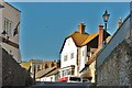
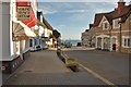
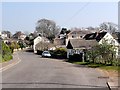
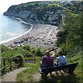
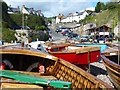
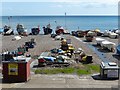
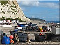
100 photos from this area
Area Information
Key information about the EX12 2PR including its size, population, and administrative classification.
- Area Type
- Postcode
- Area Size
- 2.1 hectares
- Population
- 1413
- Population Density
- 1192 people/km²
House Prices in EX12 2PR
14
Properties
£589,278
Average Sold Price
£330,000
Lowest Price
£875,000
Highest Price
Showing 14 properties
| Address | Type | Beds | Baths | Last Sale Price | Last Sale Date | |
|---|---|---|---|---|---|---|
| Rosemerryn, 70 Beer Road, Seaton, EX12 2PR | house | 4 | 2 | £696,500 | Sep 2024 | |
| Cliffhanger, 74 Beer Road, Seaton, EX12 2PR | Land | - | - | £850,000 | Jun 2021 | |
| 76 Beer Road, Seaton, EX12 2PR | Detached | 5 | 2 | £875,000 | Dec 2020 | |
| Picton House, 72 Beer Road, Seaton, EX12 2PR | Detached | 5 | 2 | £780,000 | Sep 2020 | |
| Blue Seas, 68 Beer Road, Seaton, EX12 2PR | Bungalow | - | - | £402,000 | Mar 2016 | |
| Seaways, 65 Beer Road, Seaton, EX12 2PR | Bungalow | 3 | - | £660,000 | Oct 2014 | |
| Sanderling, 62 Beer Road, Seaton, EX12 2PR | Detached | 3 | - | £360,000 | Aug 2014 | |
| Bucknell, 66 Beer Road, Seaton, EX12 2PR | Bungalow | 2 | - | £330,000 | Nov 2012 | |
| Littlegate, 64 Beer Road, Seaton, EX12 2PR | house | - | - | £350,000 | Dec 2010 | |
| White Stones, 60 Beer Road, Seaton, EX12 2PR | Bungalow | 2 | 1 | - | - |
Page 1 of 2
Energy Efficiency in EX12 2PR
Amenities
Schools
| Rank | School | Type | Entry gender | Ages |
|---|
Explore more schools in this area
Go to Schools tabDemographics
Household Size
Two person
most common
Accommodation Type
Houses
most common
Tenure
89
majority
Ethnic Group
White
most common
Religion
N/A
most common
Household Composition
N/A
most common
Age
70
median
Elderly (65+ years)
most common
Household Deprivation
N/A
with no deprivation
NS-SEC
40
in Lower managerial occupations
Explore more demographic insights in this area
Go to Demographics tabPlanning
Planning Constraints
- Flood RiskPremium
- Ramsar Wetland SitesPremium
- Area of Outstanding Natural BeautyPremium
- Protected Nature ReservePremium
- Protected WoodlandPremium