Area Overview for EX12 2PT
Photos of EX12 2PT
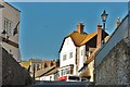
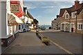
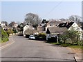
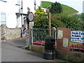
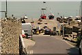
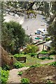
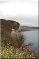
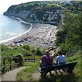
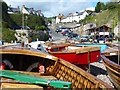
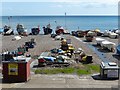
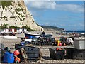
100 photos from this area
Area Information
Key information about the EX12 2PT including its size, population, and administrative classification.
- Area Type
- Postcode
- Area Size
- 9.6 hectares
- Population
- 1413
- Population Density
- 1192 people/km²
House Prices in EX12 2PT
27
Properties
£502,064
Average Sold Price
£157,500
Lowest Price
£840,000
Highest Price
Showing 27 properties
| Address | Type | Beds | Baths | Last Sale Price | Last Sale Date | |
|---|---|---|---|---|---|---|
| Combecroft, 85 Beer Road, Seaton, EX12 2PT | Bungalow | 2 | 2 | £550,000 | Oct 2025 | |
| Stella Maris, 84 Beer Road, Seaton, EX12 2PT | Terraced | 5 | 3 | £840,000 | Jul 2024 | |
| 83 Beer Road, Seaton, EX12 2PT | Detached | - | - | £565,000 | Jan 2022 | |
| The Corner House, 90 Beer Road, Seaton, EX12 2PT | Detached | 2 | 2 | £810,000 | Nov 2020 | |
| 82 Beer Road, Seaton, EX12 2PT | Detached | 5 | 3 | £635,000 | Sep 2017 | |
| 96 Beer Road, Seaton, EX12 2PT | Semi-detached | 3 | - | £333,332 | Jan 2016 | |
| 91 Beer Road, Seaton, EX12 2PT | Detached | 2 | 1 | £635,000 | Jan 2015 | |
| Ashurst, 81 Beer Road, Seaton, EX12 2PT | Bungalow | 5 | - | £455,000 | Sep 2014 | |
| Foxfield, 92 Beer Road, Seaton, EX12 2PT | Detached | 4 | 3 | £556,000 | Jul 2014 | |
| Tricks End, 110 Beer Road, Seaton, EX12 2PT | Detached | - | - | £505,000 | Feb 2005 |
Page 1 of 3
Energy Efficiency in EX12 2PT
Amenities
Schools
| Rank | School | Type | Entry gender | Ages |
|---|
Explore more schools in this area
Go to Schools tabDemographics
Household Size
Two person
most common
Accommodation Type
Houses
most common
Tenure
89
majority
Ethnic Group
White
most common
Religion
N/A
most common
Household Composition
N/A
most common
Age
70
median
Elderly (65+ years)
most common
Household Deprivation
N/A
with no deprivation
NS-SEC
40
in Lower managerial occupations
Explore more demographic insights in this area
Go to Demographics tabPlanning
Planning Constraints
- Flood RiskPremium
- Ramsar Wetland SitesPremium
- Area of Outstanding Natural BeautyPremium
- Protected Nature ReservePremium
- Protected WoodlandPremium