Area Overview for DT2 9DG
Photos of DT2 9DG
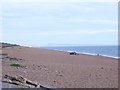
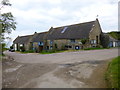

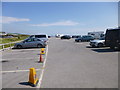
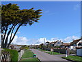
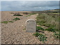
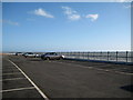
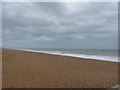
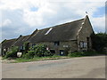
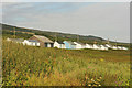
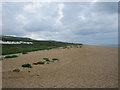
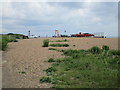
83 photos from this area
Area Information
Key information about the DT2 9DG including its size, population, and administrative classification.
- Area Type
- Postcode
- Area Size
- 46.0 hectares
- Population
- 1848
- Population Density
- 57 people/km²
House Prices in DT2 9DG
45
Properties
£456,246
Average Sold Price
£129,650
Lowest Price
£695,000
Highest Price
Showing 45 properties
| Address | Type | Beds | Baths | Last Sale Price | Last Sale Date | |
|---|---|---|---|---|---|---|
| 2, St Giles, Beach Road, West Bexington, DT2 9DG | Terraced | 4 | 1 | £450,000 | Jul 2024 | |
| Chalet 9, Beach Road, West Bexington, DT2 9DG | Detached | 2 | 1 | £450,000 | Jun 2024 | |
| Linden Lea, Beach Road, West Bexington, DT2 9DG | Bungalow | - | - | £695,000 | Apr 2023 | |
| Spindrift, Beach Road, West Bexington, DT2 9DG | Semi-detached | 3 | - | £500,000 | Sep 2020 | |
| Haliki, Beach Road, West Bexington, DT2 9DG | Detached | 4 | 3 | £625,000 | Jun 2019 | |
| Merrow, Beach Road, West Bexington, DT2 9DG | Bungalow | - | - | £555,000 | Mar 2019 | |
| Seascape, Beach Road, West Bexington, DT2 9DG | Bungalow | - | - | £400,000 | Jan 2015 | |
| Landrake, Beach Road, West Bexington, DT2 9DG | Bungalow | 3 | 3 | £465,000 | Aug 2014 | |
| 5, St Giles, Beach Road, West Bexington, DT2 9DG | Terraced | 3 | 1 | £292,000 | Jul 2014 | |
| High Views, Beach Road, West Bexington, DT2 9DG | house | - | - | £470,000 | Oct 2012 |
Page 1 of 5
Energy Efficiency in DT2 9DG
Amenities
Schools
| Rank | School | Type | Entry gender | Ages |
|---|
Explore more schools in this area
Go to Schools tabDemographics
Household Size
Two person
most common
Accommodation Type
Houses
most common
Tenure
77
majority
Ethnic Group
White
most common
Religion
N/A
most common
Household Composition
N/A
most common
Age
47
median
Elderly (65+ years)
most common
Household Deprivation
N/A
with no deprivation
NS-SEC
41
in Lower managerial occupations
Explore more demographic insights in this area
Go to Demographics tabPlanning
Planning Constraints
- Flood RiskPremium
- Ramsar Wetland SitesPremium
- Area of Outstanding Natural BeautyPremium
- Protected Nature ReservePremium
- Protected WoodlandPremium