Area Overview for DT2 9DD
Photos of DT2 9DD
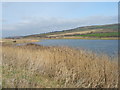
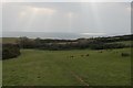
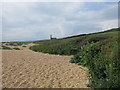
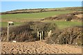
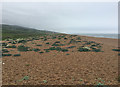
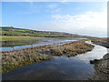
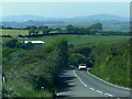
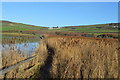
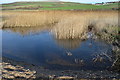
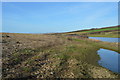
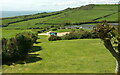
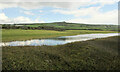
48 photos from this area
Area Information
Key information about the DT2 9DD including its size, population, and administrative classification.
- Area Type
- Postcode
- Area Size
- 1.2 km²
- Population
- 1848
- Population Density
- 57 people/km²
House Prices in DT2 9DD
30
Properties
£449,142
Average Sold Price
£106,000
Lowest Price
£775,000
Highest Price
Showing 30 properties
| Address | Type | Beds | Baths | Last Sale Price | Last Sale Date | |
|---|---|---|---|---|---|---|
| Cranford, Swyre Road, West Bexington, DT2 9DD | Bungalow | - | - | £775,000 | Jul 2024 | |
| Wayside, Swyre Road, West Bexington, DT2 9DD | house | - | - | £700,000 | Mar 2022 | |
| Meadfoot, Swyre Road, West Bexington, DT2 9DD | house | - | - | £641,111 | Mar 2016 | |
| Silvercroft, Swyre Road, West Bexington, DT2 9DD | Bungalow | 4 | 2 | £429,950 | Mar 2015 | |
| Bradstone, Swyre Road, West Bexington, DT2 9DD | Bungalow | - | - | £300,000 | Sep 2014 | |
| Mere House, Swyre Road, West Bexington, DT2 9DD | Detached | - | - | £400,000 | Dec 2013 | |
| Pebbles, Swyre Road, West Bexington, DT2 9DD | Bungalow | 3 | - | £430,000 | May 2012 | |
| Hillside, Swyre Road, West Bexington, DT2 9DD | house | 3 | - | £543,500 | May 2012 | |
| Marmaris, Swyre Road, West Bexington, DT2 9DD | Detached | - | - | £460,000 | Jul 2007 | |
| Blegberry, Swyre Road, West Bexington, DT2 9DD | house | - | - | £106,000 | Sep 1999 |
Page 1 of 3
Energy Efficiency in DT2 9DD
Amenities
Schools
| Rank | School | Type | Entry gender | Ages |
|---|
Explore more schools in this area
Go to Schools tabDemographics
Household Size
Two person
most common
Accommodation Type
Houses
most common
Tenure
77
majority
Ethnic Group
White
most common
Religion
N/A
most common
Household Composition
N/A
most common
Age
47
median
Elderly (65+ years)
most common
Household Deprivation
N/A
with no deprivation
NS-SEC
41
in Lower managerial occupations
Explore more demographic insights in this area
Go to Demographics tabPlanning
Planning Constraints
- Flood RiskPremium
- Ramsar Wetland SitesPremium
- Area of Outstanding Natural BeautyPremium
- Protected Nature ReservePremium
- Protected WoodlandPremium