Area Overview for DT11 9DJ
Photos of DT11 9DJ
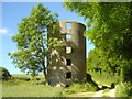
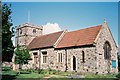
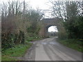
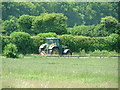
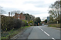
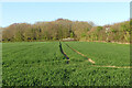
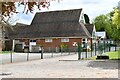

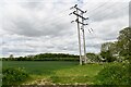
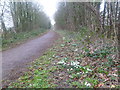
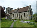
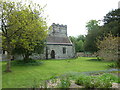
16 photos from this area
Area Information
Key information about the DT11 9DJ including its size, population, and administrative classification.
- Area Type
- Postcode
- Area Size
- 6.0 hectares
- Population
- 1826
- Population Density
- 99 people/km²
House Prices in DT11 9DJ
28
Properties
£210,545
Average Sold Price
£70,000
Lowest Price
£345,000
Highest Price
Showing 28 properties
| Address | Type | Beds | Baths | Last Sale Price | Last Sale Date | |
|---|---|---|---|---|---|---|
| Glyndrew, High Street, Spetisbury, DT11 9DJ | Detached | - | - | £345,000 | Sep 2021 | |
| Robins End, High Street, Spetisbury, DT11 9DJ | Bungalow | 2 | - | £275,000 | Jul 2017 | |
| Gowan Cottage, High Street, Spetisbury, DT11 9DJ | Semi-detached | - | - | £215,000 | Sep 2015 | |
| 30 High Street, Spetisbury, DT11 9DJ | Detached | 2 | 1 | £270,000 | Aug 2015 | |
| Park View, High Street, Spetisbury, DT11 9DJ | Semi-detached | 2 | - | £169,000 | Apr 2015 | |
| 29 High Street, Spetisbury, DT11 9DJ | Terraced | 2 | 1 | £151,000 | Feb 2014 | |
| 28 High Street, Spetisbury, DT11 9DJ | Terraced | - | - | £187,000 | Jul 2006 | |
| Sunnycombe, High Street, Spetisbury, DT11 9DJ | Semi-detached | 3 | 1 | £225,000 | Feb 2006 | |
| Marigold Cottage, 19-20 High Street, Spetisbury, DT11 9DJ | Detached | - | - | £280,000 | Jan 2002 | |
| Charlotte, 34A High Street, Spetisbury, DT11 9DJ | Bungalow | - | - | £129,000 | May 2001 |
Page 1 of 3
Energy Efficiency in DT11 9DJ
Amenities
Schools
| Rank | School | Type | Entry gender | Ages |
|---|
Explore more schools in this area
Go to Schools tabDemographics
Household Size
Two person
most common
Accommodation Type
Houses
most common
Tenure
81
majority
Ethnic Group
White
most common
Religion
N/A
most common
Household Composition
N/A
most common
Age
47
median
Adults (30-64 years)
most common
Household Deprivation
N/A
with no deprivation
NS-SEC
40
in Lower managerial occupations
Explore more demographic insights in this area
Go to Demographics tabPlanning
Planning Constraints
- Flood RiskPremium
- Ramsar Wetland SitesPremium
- Area of Outstanding Natural BeautyPremium
- Protected Nature ReservePremium
- Protected WoodlandPremium