Area Overview for DT11 9DF
Photos of DT11 9DF
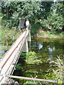
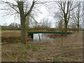
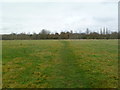
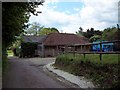
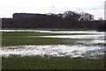

32 photos from this area
Area Information
Key information about the DT11 9DF including its size, population, and administrative classification.
- Area Type
- Postcode
- Area Size
- 44.0 hectares
- Population
- 1826
- Population Density
- 99 people/km²
House Prices in DT11 9DF
13
Properties
£593,300
Average Sold Price
£331,100
Lowest Price
£850,000
Highest Price
Showing 13 properties
| Address | Type | Beds | Baths | Last Sale Price | Last Sale Date | |
|---|---|---|---|---|---|---|
| Clapcotts Farmhouse, Bournemouth Road, Spetisbury, DT11 9DF | house | - | - | £600,000 | Apr 2025 | |
| Clapcotts Farm Cottage, 2 Bournemouth Road, Spetisbury, DT11 9DF | house | - | - | £331,100 | Apr 2025 | |
| Chestnut House, High Street, Spetisbury, DT11 9DF | house | - | - | £767,000 | Sep 2021 | |
| Copper Beech Lodge, High Street, Spetisbury, DT11 9DF | Detached | 3 | 1 | £410,000 | Mar 2021 | |
| Copper Beech House, High Street, Spetisbury, DT11 9DF | house | - | - | £670,000 | Mar 2021 | |
| Jestys, High Street, Spetisbury, DT11 9DF | Detached | 4 | 2 | £525,000 | Sep 2020 | |
| The Old Mill House, Bournemouth Road, Spetisbury, DT11 9DF | house | 4 | - | £850,000 | Aug 2010 | |
| Chesterfield, High Street, Spetisbury, DT11 9DF | Detached | 3 | 2 | - | - | |
| Old School House, High Street, Spetisbury, DT11 9DF | Semi-detached | 3 | - | - | - | |
| Spetisbury Hall, High Street, Spetisbury, DT11 9DF | Land | - | - | - | - |
Page 1 of 2
Energy Efficiency in DT11 9DF
Amenities
Schools
| Rank | School | Type | Entry gender | Ages |
|---|
Explore more schools in this area
Go to Schools tabDemographics
Household Size
Two person
most common
Accommodation Type
Houses
most common
Tenure
81
majority
Ethnic Group
White
most common
Religion
N/A
most common
Household Composition
N/A
most common
Age
47
median
Adults (30-64 years)
most common
Household Deprivation
N/A
with no deprivation
NS-SEC
40
in Lower managerial occupations
Explore more demographic insights in this area
Go to Demographics tabPlanning
Planning Constraints
- Flood RiskPremium
- Ramsar Wetland SitesPremium
- Area of Outstanding Natural BeautyPremium
- Protected Nature ReservePremium
- Protected WoodlandPremium