Area Overview for DT10 2HG
Photos of DT10 2HG
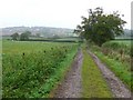
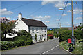
6 photos from this area
Area Information
Key information about the DT10 2HG including its size, population, and administrative classification.
- Area Type
- Postcode
- Area Size
- 43.9 hectares
- Population
- 2193
- Population Density
- 102 people/km²
House Prices in DT10 2HG
26
Properties
£329,050
Average Sold Price
£120,000
Lowest Price
£670,000
Highest Price
Showing 26 properties
| Address | Type | Beds | Baths | Last Sale Price | Last Sale Date | |
|---|---|---|---|---|---|---|
| Priestlands, Common Lane, Broad Oak, DT10 2HG | Bungalow | 4 | 2 | £635,000 | Aug 2024 | |
| Green Acres, Common Lane, Broad Oak, DT10 2HG | house | 4 | 2 | £670,000 | Jul 2024 | |
| Candleford, Common Lane, Broad Oak, DT10 2HG | Bungalow | 4 | 2 | £372,500 | Oct 2020 | |
| Appletree Cottage, Common Lane, Broad Oak, DT10 2HG | house | - | - | £520,000 | Oct 2018 | |
| Kingswood, Common Lane, Broad Oak, DT10 2HG | house | - | - | £461,250 | Sep 2015 | |
| Spring Cottage, Common Lane, Broad Oak, DT10 2HG | Cottage | 4 | 2 | £460,000 | Sep 2015 | |
| Little Acorns, Common Lane, Broad Oak, DT10 2HG | Detached | - | - | £335,000 | May 2005 | |
| Grand View, Common Lane, Broad Oak, DT10 2HG | Detached | - | - | £125,000 | Sep 2001 | |
| Vale Edge, Common Lane, Broad Oak, DT10 2HG | Detached | - | - | £290,000 | Jun 2001 | |
| Wynard, Common Lane, Broad Oak, DT10 2HG | Detached | - | - | £175,000 | Aug 2000 |
Page 1 of 3
Energy Efficiency in DT10 2HG
Amenities
Schools
| Rank | School | Type | Entry gender | Ages |
|---|
Explore more schools in this area
Go to Schools tabDemographics
Household Size
Two person
most common
Accommodation Type
Houses
most common
Tenure
79
majority
Ethnic Group
White
most common
Religion
N/A
most common
Household Composition
N/A
most common
Age
47
median
Adults (30-64 years)
most common
Household Deprivation
N/A
with no deprivation
NS-SEC
33
in Lower managerial occupations
Explore more demographic insights in this area
Go to Demographics tabPlanning
Planning Constraints
- Flood RiskPremium
- Ramsar Wetland SitesPremium
- Area of Outstanding Natural BeautyPremium
- Protected Nature ReservePremium
- Protected WoodlandPremium