Area Overview for BS7 9SJ
Photos of BS7 9SJ
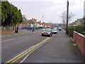
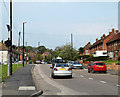
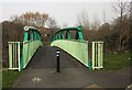
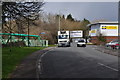


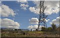
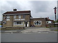
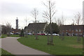
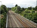
67 photos from this area
Area Information
Key information about the BS7 9SJ including its size, population, and administrative classification.
- Area Type
- Postcode
- Area Size
- 8465 m²
- Population
- 1722
- Population Density
- 4096 people/km²
House Prices in BS7 9SJ
30
Properties
£170,888
Average Sold Price
£56,000
Lowest Price
£390,150
Highest Price
Showing 30 properties
| Address | Type | Beds | Baths | Last Sale Price | Last Sale Date | |
|---|---|---|---|---|---|---|
| 164 Dovercourt Road, Horfield, Bristol, BS7 9SJ | house | - | - | £320,000 | Feb 2022 | |
| 162 Dovercourt Road, Horfield, Bristol, BS7 9SJ | Terraced | 3 | 1 | £390,150 | Feb 2021 | |
| 166 Dovercourt Road, Horfield, Bristol, BS7 9SJ | Terraced | 3 | 2 | £350,000 | Nov 2018 | |
| 168 Dovercourt Road, Horfield, Bristol, BS7 9SJ | house | - | - | £248,000 | Oct 2018 | |
| 196 Dovercourt Road, Horfield, Bristol, BS7 9SJ | house | 3 | - | £164,500 | Apr 2010 | |
| 152 Dovercourt Road, Horfield, Bristol, BS7 9SJ | Terraced | - | - | £124,000 | Sep 2003 | |
| 186 Dovercourt Road, Horfield, Bristol, BS7 9SJ | house | - | - | £96,000 | Jun 2002 | |
| 200 Dovercourt Road, Horfield, Bristol, BS7 9SJ | Terraced | 4 | 1 | £94,000 | Oct 2001 | |
| 174 Dovercourt Road, Horfield, Bristol, BS7 9SJ | Flat | 1 | 1 | £90,000 | Oct 2001 | |
| 170 Dovercourt Road, Horfield, Bristol, BS7 9SJ | Terraced | - | - | £59,000 | Jun 1999 |
Page 1 of 3
Energy Efficiency in BS7 9SJ
Amenities
Schools
| Rank | School | Type | Entry gender | Ages |
|---|
Explore more schools in this area
Go to Schools tabDemographics
Household Size
Family (3-5 people)
most common
Accommodation Type
Houses
most common
Tenure
60
majority
Ethnic Group
White
most common
Religion
N/A
most common
Household Composition
N/A
most common
Age
47
median
Adults (30-64 years)
most common
Household Deprivation
N/A
with no deprivation
NS-SEC
35
in Lower managerial occupations
Explore more demographic insights in this area
Go to Demographics tabPlanning
Planning Constraints
- Flood RiskPremium
- Ramsar Wetland SitesPremium
- Area of Outstanding Natural BeautyPremium
- Protected Nature ReservePremium
- Protected WoodlandPremium