Area Overview for BS7 0RS
Photos of BS7 0RS

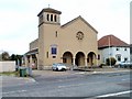
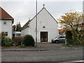
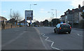
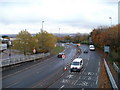
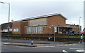
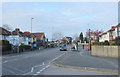
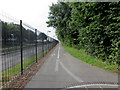
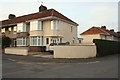

100 photos from this area
Area Information
Key information about the BS7 0RS including its size, population, and administrative classification.
- Area Type
- Postcode
- Area Size
- 8235 m²
- Population
- 1587
- Population Density
- 5989 people/km²
House Prices in BS7 0RS
25
Properties
£228,698
Average Sold Price
£42,000
Lowest Price
£395,050
Highest Price
Showing 25 properties
| Address | Type | Beds | Baths | Last Sale Price | Last Sale Date | |
|---|---|---|---|---|---|---|
| 1A Third Avenue, Filton, BS7 0RS | Terraced | 3 | 1 | £386,000 | Aug 2025 | |
| 45 Third Avenue, Filton, BS7 0RS | Terraced | 3 | 2 | £395,050 | Nov 2024 | |
| 43 Third Avenue, Filton, BS7 0RS | Terraced | 3 | 1 | £385,000 | Sep 2023 | |
| 27 Third Avenue, Filton, BS7 0RS | Terraced | 3 | 1 | £315,000 | Aug 2023 | |
| 15 Third Avenue, Filton, BS7 0RS | Terraced | 3 | 1 | £327,000 | May 2023 | |
| 35 Third Avenue, Filton, BS7 0RS | house | 6 | 3 | £295,000 | Sep 2021 | |
| 37 Third Avenue, Filton, BS7 0RS | house | 3 | - | £320,000 | Dec 2020 | |
| 39 Third Avenue, Filton, BS7 0RS | Terraced | 6 | 2 | £290,000 | Apr 2019 | |
| 47 Third Avenue, Filton, BS7 0RS | house | 3 | 2 | £269,950 | Aug 2018 | |
| 5 Third Avenue, Filton, BS7 0RS | house | 3 | 1 | £275,000 | Jan 2018 |
Page 1 of 3
Energy Efficiency in BS7 0RS
Amenities
Schools
| Rank | School | Type | Entry gender | Ages |
|---|
Explore more schools in this area
Go to Schools tabDemographics
Household Size
Family (3-5 people)
most common
Accommodation Type
Houses
most common
Tenure
55
majority
Ethnic Group
White
most common
Religion
N/A
most common
Household Composition
N/A
most common
Age
22
median
Young Adults (15-29 years)
most common
Household Deprivation
N/A
with no deprivation
NS-SEC
26
in Lower managerial occupations
Explore more demographic insights in this area
Go to Demographics tabPlanning
Planning Constraints
- Flood RiskPremium
- Ramsar Wetland SitesPremium
- Area of Outstanding Natural BeautyPremium
- Protected Nature ReservePremium
- Protected WoodlandPremium