Area Overview for BS7 0RL
Photos of BS7 0RL

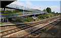
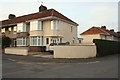

100 photos from this area
Area Information
Key information about the BS7 0RL including its size, population, and administrative classification.
- Area Type
- Postcode
- Area Size
- 1.3 hectares
- Population
- 1587
- Population Density
- 5989 people/km²
House Prices in BS7 0RL
34
Properties
£198,152
Average Sold Price
£30,500
Lowest Price
£468,000
Highest Price
Showing 34 properties
| Address | Type | Beds | Baths | Last Sale Price | Last Sale Date | |
|---|---|---|---|---|---|---|
| 82 Northville Road, Filton, BS7 0RL | Semi-detached | 3 | 1 | £369,000 | Mar 2025 | |
| 92 Northville Road, Filton, BS7 0RL | Semi-detached | 3 | - | £468,000 | Feb 2025 | |
| 104 Northville Road, Filton, BS7 0RL | house | - | - | £356,000 | Aug 2023 | |
| 126 Northville Road, Filton, BS7 0RL | house | 4 | 1 | £357,500 | Jul 2022 | |
| 132 Northville Road, Filton, BS7 0RL | Terraced | 4 | 1 | £240,000 | Oct 2019 | |
| 98 Northville Road, Filton, BS7 0RL | Semi-detached | 3 | 1 | £310,000 | Aug 2019 | |
| 124 Northville Road, Filton, BS7 0RL | Semi-detached | 5 | 3 | £270,000 | Mar 2019 | |
| 130 Northville Road, Filton, BS7 0RL | Terraced | 4 | 1 | £253,000 | Nov 2018 | |
| 112 Northville Road, Filton, BS7 0RL | house | - | - | £253,000 | Oct 2018 | |
| 118 Northville Road, Filton, BS7 0RL | house | - | - | £220,000 | Oct 2018 |
Page 1 of 4
Energy Efficiency in BS7 0RL
Amenities
Schools
| Rank | School | Type | Entry gender | Ages |
|---|
Explore more schools in this area
Go to Schools tabDemographics
Household Size
Family (3-5 people)
most common
Accommodation Type
Houses
most common
Tenure
55
majority
Ethnic Group
White
most common
Religion
N/A
most common
Household Composition
N/A
most common
Age
22
median
Young Adults (15-29 years)
most common
Household Deprivation
N/A
with no deprivation
NS-SEC
26
in Lower managerial occupations
Explore more demographic insights in this area
Go to Demographics tabPlanning
Planning Constraints
- Flood RiskPremium
- Ramsar Wetland SitesPremium
- Area of Outstanding Natural BeautyPremium
- Protected Nature ReservePremium
- Protected WoodlandPremium