Area Overview for BS6 6ET
Photos of BS6 6ET
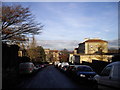
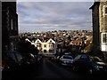
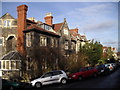
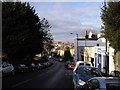
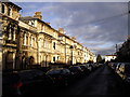
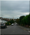
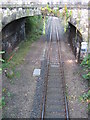
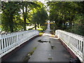
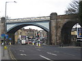
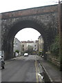
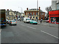
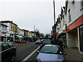
100 photos from this area
Area Information
Key information about the BS6 6ET including its size, population, and administrative classification.
- Area Type
- Postcode
- Area Size
- 1.0 hectares
- Population
- 1696
- Population Density
- 16876 people/km²
House Prices in BS6 6ET
46
Properties
£395,620
Average Sold Price
£110,000
Lowest Price
£750,000
Highest Price
Showing 46 properties
| Address | Type | Beds | Baths | Last Sale Price | Last Sale Date | |
|---|---|---|---|---|---|---|
| 81 Waverley Road, Cotham, Bristol, BS6 6ET | Terraced | 5 | 3 | £750,000 | Dec 2025 | |
| 69 Waverley Road, Cotham, Bristol, BS6 6ET | Terraced | 7 | 4 | £625,000 | Aug 2024 | |
| 49 Waverley Road, Cotham, Bristol, BS6 6ET | house | - | - | £583,200 | Dec 2015 | |
| 73 Waverley Road, Cotham, Bristol, BS6 6ET | Terraced | - | - | £407,000 | Oct 2006 | |
| 45 Waverley Road, Cotham, Bristol, BS6 6ET | house | 7 | 3 | £410,000 | May 2006 | |
| 61 Waverley Road, Cotham, Bristol, BS6 6ET | Terraced | 3 | 1 | £300,000 | Jul 2002 | |
| 63 Waverley Road, Cotham, Bristol, BS6 6ET | house | 6 | 2 | £310,000 | Jan 2002 | |
| 71 Waverley Road, Cotham, Bristol, BS6 6ET | house | 7 | 2 | £246,000 | Sep 2001 | |
| 79 Waverley Road, Cotham, Bristol, BS6 6ET | house | 5 | 3 | £215,000 | Jan 2001 | |
| 65 Waverley Road, Cotham, Bristol, BS6 6ET | Terraced | 6 | 2 | £110,000 | Aug 1996 |
Page 1 of 5
Energy Efficiency in BS6 6ET
Amenities
Schools
| Rank | School | Type | Entry gender | Ages |
|---|
Explore more schools in this area
Go to Schools tabDemographics
Household Size
Two person
most common
Accommodation Type
Flats
most common
Tenure
40
majority
Ethnic Group
White
most common
Religion
N/A
most common
Household Composition
N/A
most common
Age
22
median
Young Adults (15-29 years)
most common
Household Deprivation
N/A
with no deprivation
NS-SEC
34
in Lower managerial occupations
Explore more demographic insights in this area
Go to Demographics tabPlanning
Planning Constraints
- Flood RiskPremium
- Ramsar Wetland SitesPremium
- Area of Outstanding Natural BeautyPremium
- Protected Nature ReservePremium
- Protected WoodlandPremium