Area Overview for BS5 6TN
Photos of BS5 6TN

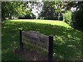
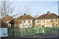
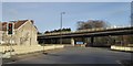

99 photos from this area
Area Information
Key information about the BS5 6TN including its size, population, and administrative classification.
- Area Type
- Postcode
- Area Size
- 9783 m²
- Population
- 2200
- Population Density
- 2856 people/km²
House Prices in BS5 6TN
24
Properties
£230,192
Average Sold Price
£46,500
Lowest Price
£402,500
Highest Price
Showing 24 properties
| Address | Type | Beds | Baths | Last Sale Price | Last Sale Date | |
|---|---|---|---|---|---|---|
| 80 Cottrell Road, Eastville, Bristol, BS5 6TN | Semi-detached | 3 | 1 | £402,500 | Jul 2025 | |
| 81 Cottrell Road, Eastville, Bristol, BS5 6TN | Semi-detached | 3 | 1 | £275,000 | Dec 2024 | |
| 85 Cottrell Road, Eastville, Bristol, BS5 6TN | Semi-detached | 3 | 1 | £250,000 | Jun 2024 | |
| 91 Cottrell Road, Eastville, Bristol, BS5 6TN | Semi-detached | 3 | 1 | £285,000 | Sep 2019 | |
| 86 Cottrell Road, Eastville, Bristol, BS5 6TN | Semi-detached | 3 | 1 | £300,000 | Sep 2019 | |
| 78 Cottrell Road, Eastville, Bristol, BS5 6TN | house | - | - | £308,000 | Jun 2018 | |
| 92A Cottrell Road, Eastville, Bristol, BS5 6TN | Flat | - | - | £200,000 | May 2018 | |
| 79 Cottrell Road, Eastville, Bristol, BS5 6TN | house | 4 | 1 | £207,500 | Feb 2016 | |
| 76 Cottrell Road, Eastville, Bristol, BS5 6TN | Semi-detached | 3 | 1 | £265,000 | Jan 2016 | |
| 77 Cottrell Road, Eastville, Bristol, BS5 6TN | house | - | - | £175,000 | Oct 2014 |
Page 1 of 3
Energy Efficiency in BS5 6TN
Amenities
Schools
| Rank | School | Type | Entry gender | Ages |
|---|
Explore more schools in this area
Go to Schools tabDemographics
Household Size
Family (3-5 people)
most common
Accommodation Type
Houses
most common
Tenure
73
majority
Ethnic Group
White
most common
Religion
N/A
most common
Household Composition
N/A
most common
Age
47
median
Adults (30-64 years)
most common
Household Deprivation
N/A
with no deprivation
NS-SEC
32
in Lower managerial occupations
Explore more demographic insights in this area
Go to Demographics tabPlanning
Planning Constraints
- Flood RiskPremium
- Ramsar Wetland SitesPremium
- Area of Outstanding Natural BeautyPremium
- Protected Nature ReservePremium
- Protected WoodlandPremium